MyTopo
Dry Hills South Nevada US Topo Map
Couldn't load pickup availability
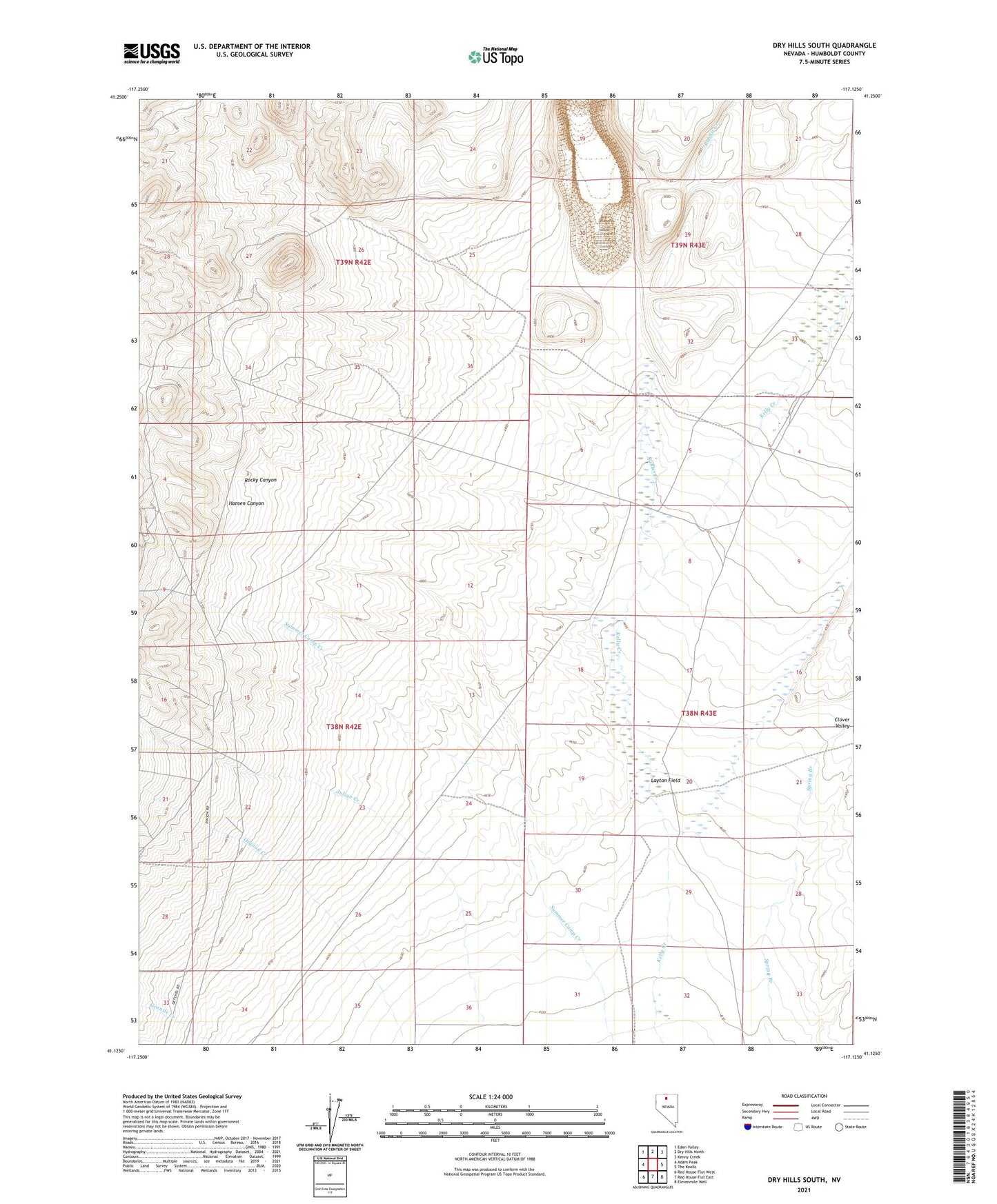
2021 topographic map quadrangle Dry Hills South in the state of Nevada. Scale: 1:24000. Based on the newly updated USGS 7.5' US Topo map series, this map is in the following counties: Humboldt. The map contains contour data, water features, and other items you are used to seeing on USGS maps, but also has updated roads and other features. This is the next generation of topographic maps. Printed on high-quality waterproof paper with UV fade-resistant inks.
Quads adjacent to this one:
West: Adam Peak
Northwest: Eden Valley
North: Dry Hills North
Northeast: Kenny Creek
East: The Knolls
Southeast: Elevenmile Well
South: Red House Flat East
Southwest: Red House Flat West
This map covers the same area as the classic USGS quad with code o41117b2.
Contains the following named places: Clover Valley, Duvivier Place, Getchell Landing Strip, Getchell Mine Dam, Hansen Canyon, Layton Field, Rabbit Creek, Riley Extension Mine, Rocky Canyon