MyTopo
Duckwater Nevada US Topo Map
Couldn't load pickup availability
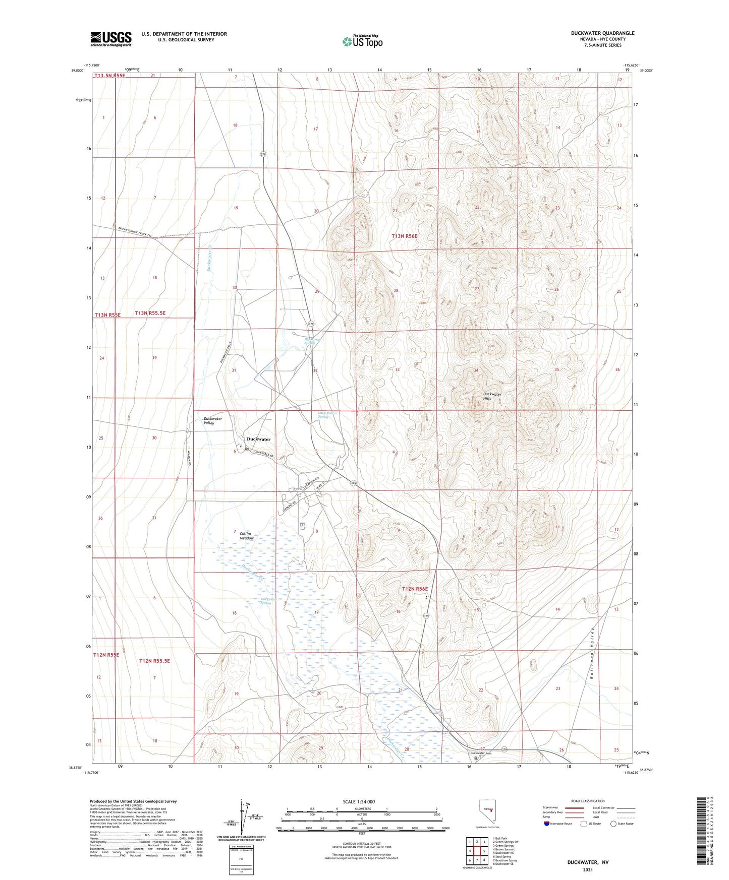
2021 topographic map quadrangle Duckwater in the state of Nevada. Scale: 1:24000. Based on the newly updated USGS 7.5' US Topo map series, this map is in the following counties: Nye. The map contains contour data, water features, and other items you are used to seeing on USGS maps, but also has updated roads and other features. This is the next generation of topographic maps. Printed on high-quality waterproof paper with UV fade-resistant inks.
Quads adjacent to this one:
West: Brown Summit
Northwest: Bull Fork
North: Green Springs SW
Northeast: Green Springs
East: Duckwater NE
Southeast: Duckwater SE
South: Bradshaw Spring
Southwest: Sand Spring
Contains the following named places: Big Warm Spring, Collins Meadow, Duckwater, Duckwater Cemetery, Duckwater Elementary School, Duckwater Hills, Duckwater Post Office, Duckwater Reservation, Duckwater Valley, Little Warm Spring, McCubes, Old Collins Spring