MyTopo
Ely Springs Nevada US Topo Map
Couldn't load pickup availability
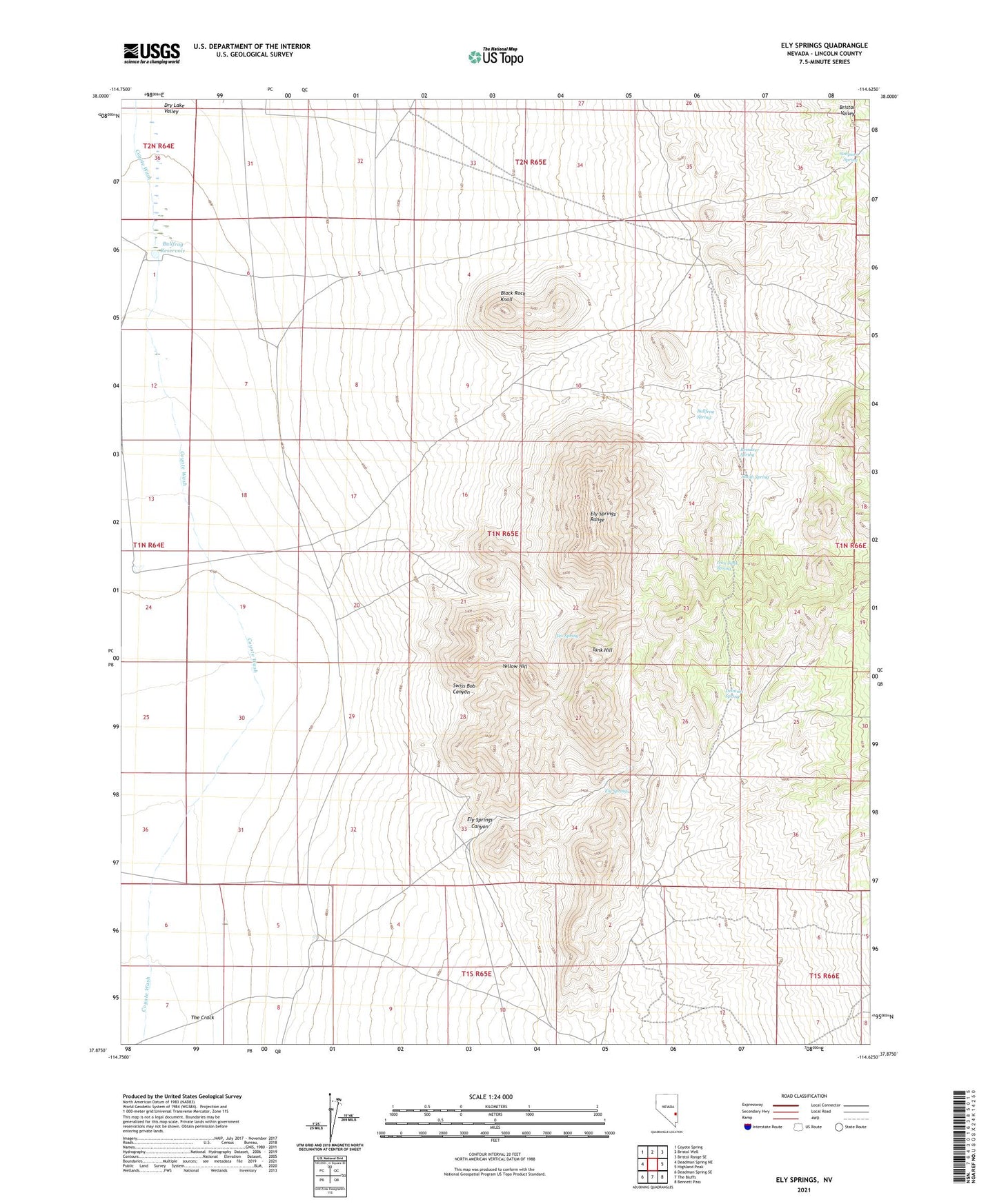
2021 topographic map quadrangle Ely Springs in the state of Nevada. Scale: 1:24000. Based on the newly updated USGS 7.5' US Topo map series, this map is in the following counties: Lincoln. The map contains contour data, water features, and other items you are used to seeing on USGS maps, but also has updated roads and other features. This is the next generation of topographic maps. Printed on high-quality waterproof paper with UV fade-resistant inks.
Quads adjacent to this one:
West: Deadman Spring NE
Northwest: Coyote Spring
North: Bristol Well
Northeast: Bristol Range SE
East: Highland Peak
Southeast: Bennett Pass
South: The Bluffs
Southwest: Deadman Spring SE
This map covers the same area as the classic USGS quad with code o37114h6.
Contains the following named places: Black Rock Knoll, Bullfrog Reservoir, Bullfrog Spring, Delmues Spring, El Rey Mine, Ely Springs, Ely Springs Canyon, Ely Springs Mining District, Ely Springs Ranch, Ely Springs Range, Iron Tank Spring, King Midas Mine, Mathews Mine, Reindeer Spring, Simpson Spring, Smith Spring, Swiss Bob Canyon, Swiss Bob Well, Tank Hill, Tex Spring, Thorley Reservoir, Yellow Hill