MyTopo
Emigrant Springs Nevada US Topo Map
Couldn't load pickup availability
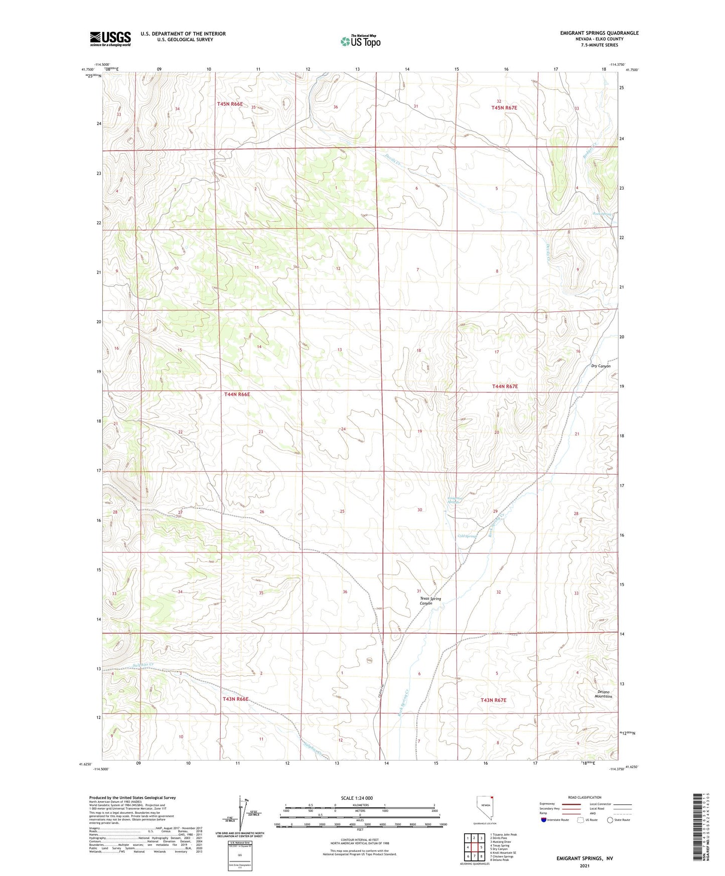
2021 topographic map quadrangle Emigrant Springs in the state of Nevada. Scale: 1:24000. Based on the newly updated USGS 7.5' US Topo map series, this map is in the following counties: Elko. The map contains contour data, water features, and other items you are used to seeing on USGS maps, but also has updated roads and other features. This is the next generation of topographic maps. Printed on high-quality waterproof paper with UV fade-resistant inks.
Quads adjacent to this one:
West: Texas Spring
Northwest: Tijuana John Peak
North: Devils Pass
Northeast: Mustang Draw
East: Dry Canyon
Southeast: Delano Peak
South: Chicken Springs
Southwest: Knoll Mountain SE
This map covers the same area as the classic USGS quad with code o41114f4.
Contains the following named places: Badger Creek, Cold Springs, Dry Canyon, Emigrant Springs, Rock Spring, Rock Springs Cow Camp, Rock Springs Well, Texas Spring Canyon, Winecup Well