MyTopo
Fagin Mountain Nevada US Topo Map
Couldn't load pickup availability
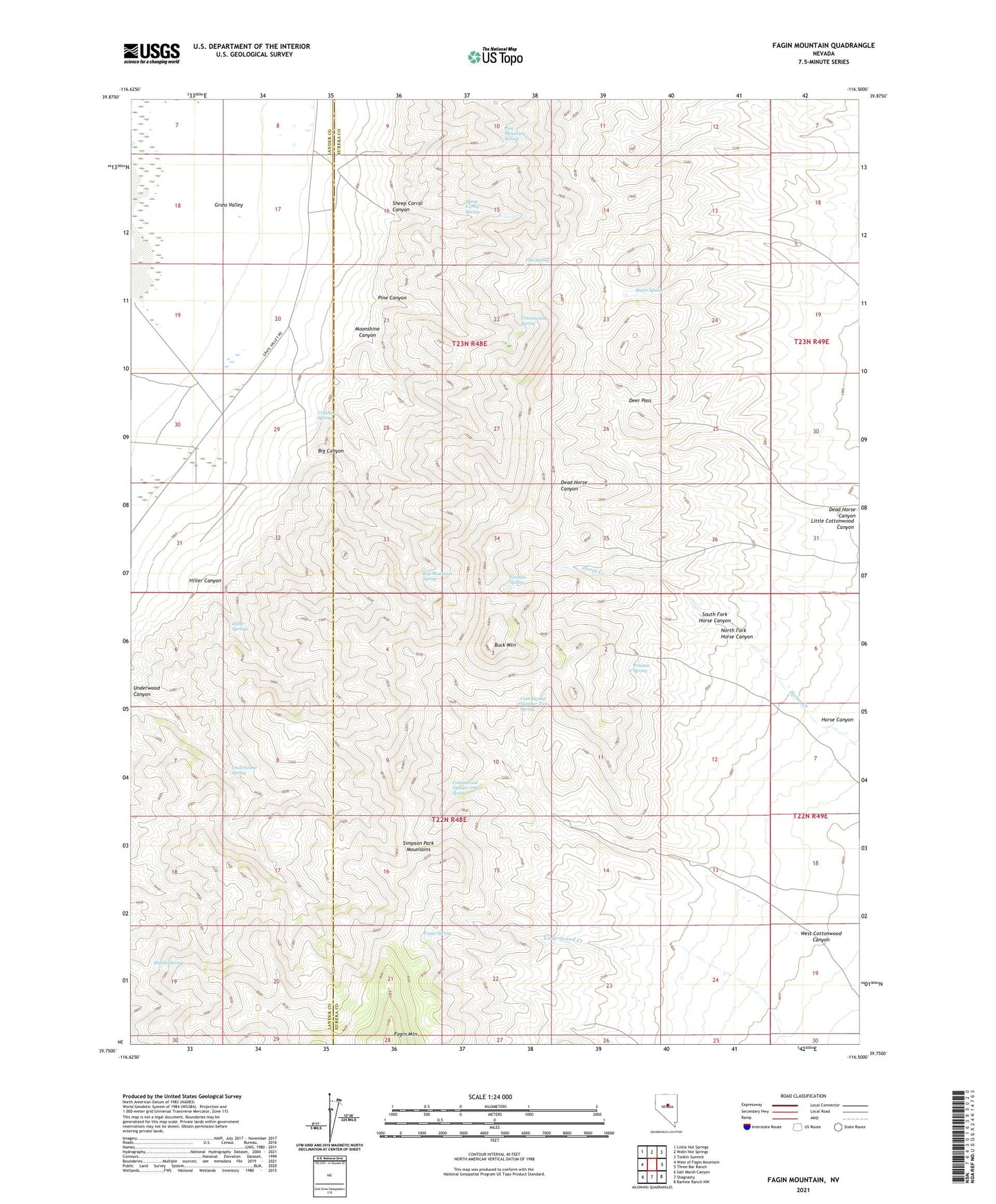
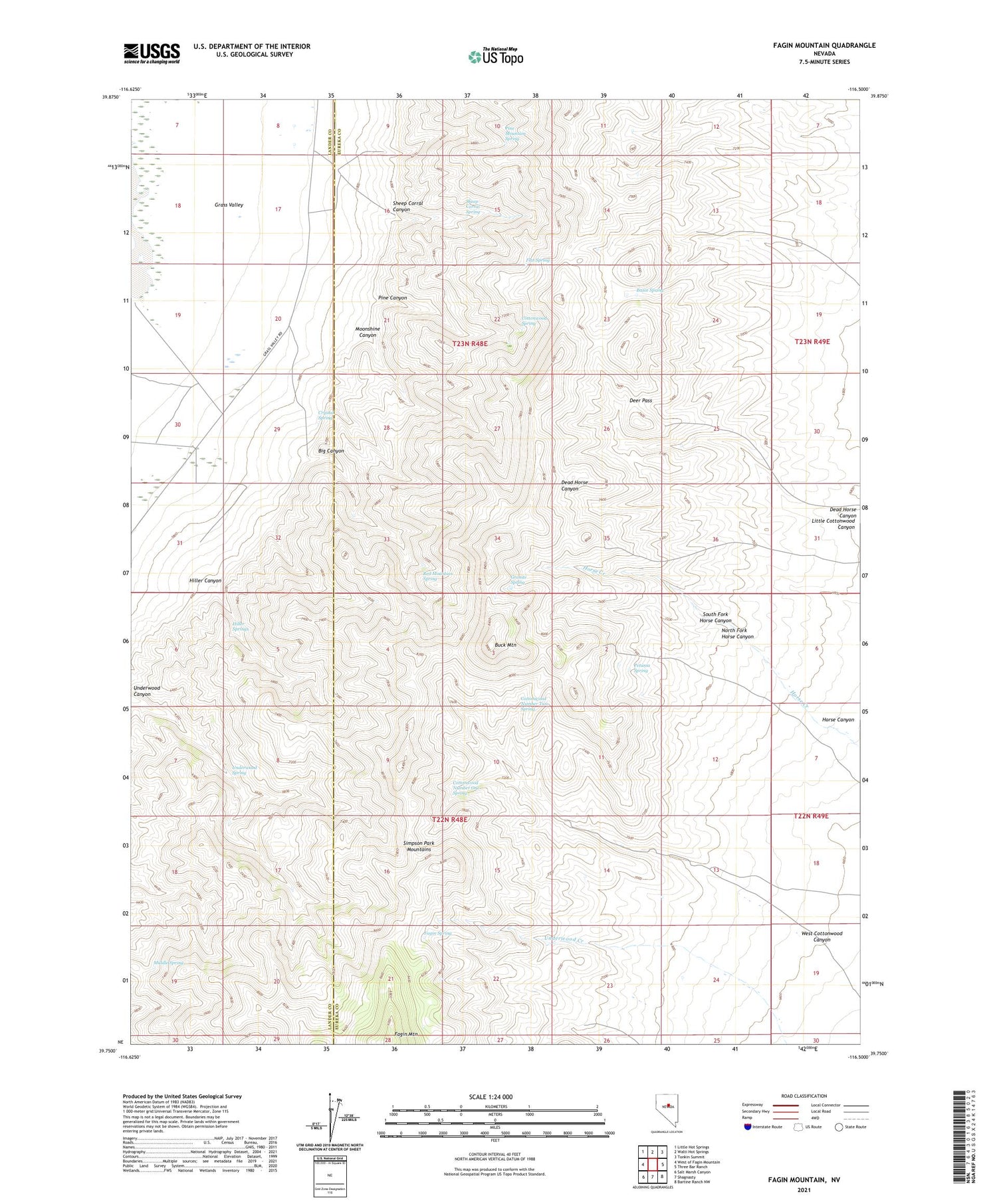
2021 topographic map quadrangle Fagin Mountain in the state of Nevada. Scale: 1:24000. Based on the newly updated USGS 7.5' US Topo map series, this map is in the following counties: Eureka, Lander. The map contains contour data, water features, and other items you are used to seeing on USGS maps, but also has updated roads and other features. This is the next generation of topographic maps. Printed on high-quality waterproof paper with UV fade-resistant inks.
Quads adjacent to this one:
West: West of Fagin Mountain
Northwest: Little Hot Springs
North: Walti Hot Springs
Northeast: Tonkin Summit
East: Three Bar Ranch
Southeast: Bartine Ranch NW
South: Shagnasty
Southwest: Salt Marsh Canyon
Contains the following named places: Basin Spring, Big Canyon, Buck Mountain, Cottonwood Number One Spring, Cottonwood Number Two Spring, Cottonwood Spring, Crystal Spring, Dead Horse Canyon, Deer Pass, Fagin Mountain, Fagin Spring, Flat Spring, Granite Spring, Hiller, Hiller Canyon, Hiller Post Office, Hiller Springs, Horse Canyon, Little Cottonwood Canyon, Middle Spring, Moonshine Canyon, North Fork Horse Canyon, Petunia Spring, Pine Canyon, Pine Mountain Spring, Red Mountain Spring, Sheep Corral Canyon, Sheep Corral Spring, South Fork Horse Canyon, Twin Springs School, Underwood Canyon, Underwood Spring, UNR Gund Ranch Airport, West Cottonwood Canyon