MyTopo
Bartine Ranch NW Nevada US Topo Map
Couldn't load pickup availability
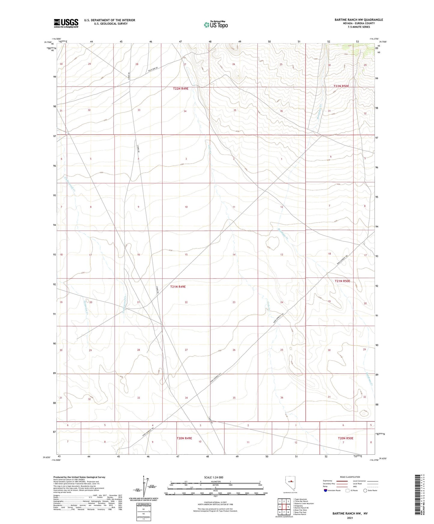
2021 topographic map quadrangle Bartine Ranch NW in the state of Nevada. Scale: 1:24000. Based on the newly updated USGS 7.5' US Topo map series, this map is in the following counties: Eureka. The map contains contour data, water features, and other items you are used to seeing on USGS maps, but also has updated roads and other features. This is the next generation of topographic maps. Printed on high-quality waterproof paper with UV fade-resistant inks.
Quads adjacent to this one:
West: Shagnasty
Northwest: Fagin Mountain
North: Three Bar Ranch
Northeast: Roberts Creek Mountain
East: Bartine Ranch NE
Southeast: Bartine Ranch
South: Bean Flat East
Southwest: Bean Flat West
This map covers the same area as the classic USGS quad with code o39116f4.
Contains the following named places: Goodwin, Mint Well, Rutabaga Creek, Underwood Creek, Willow Wash