MyTopo
Granite Peak Nevada US Topo Map
Couldn't load pickup availability
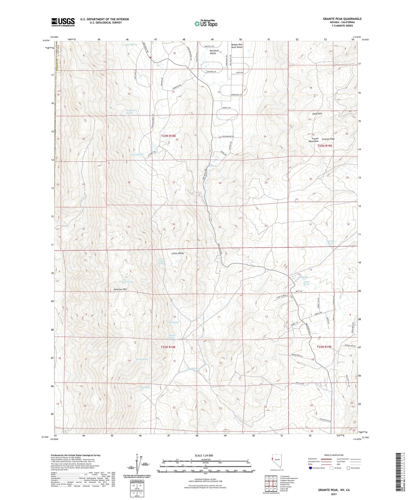
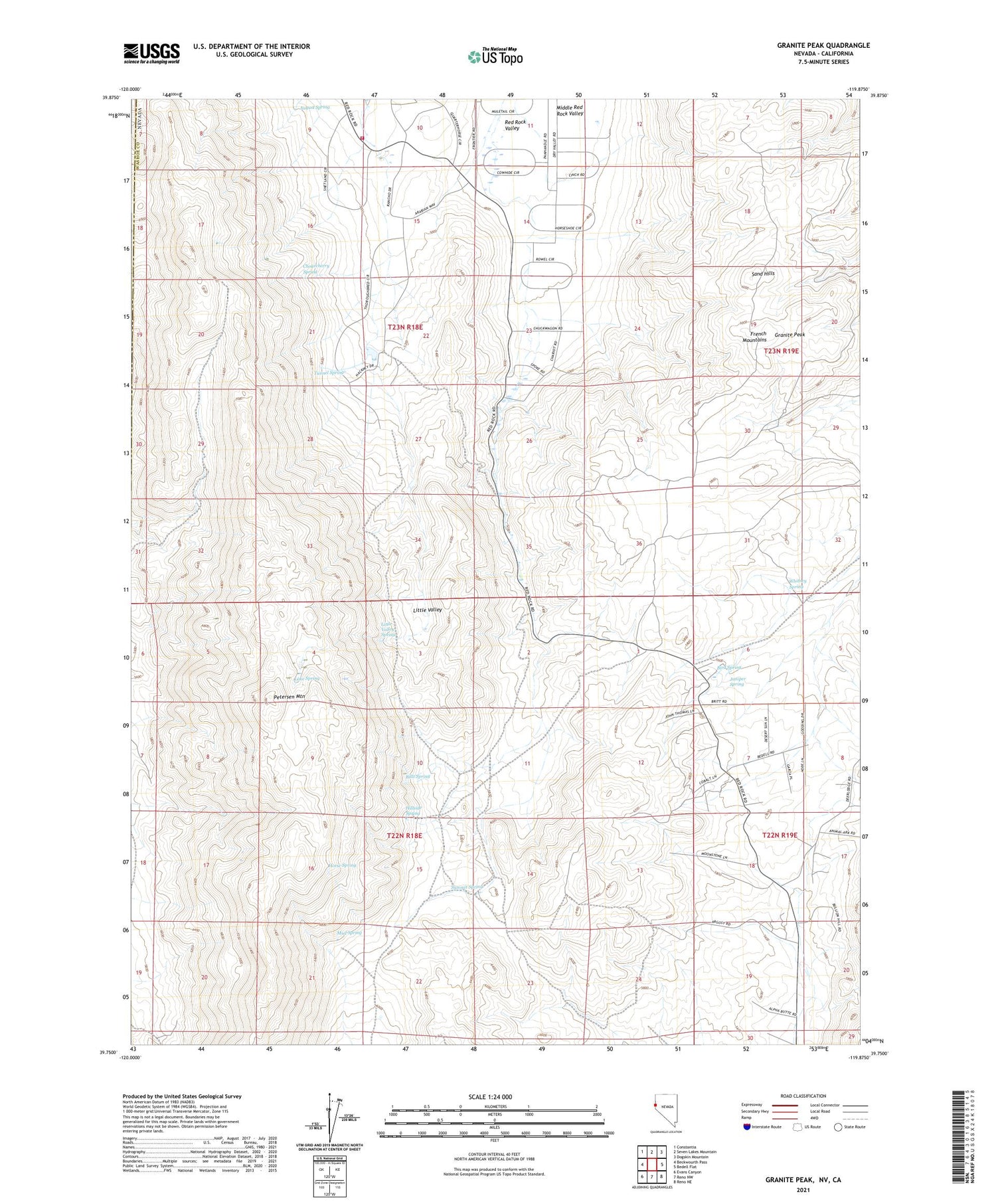
2021 topographic map quadrangle Granite Peak in the state of Nevada. Scale: 1:24000. Based on the newly updated USGS 7.5' US Topo map series, this map is in the following counties: Washoe, Lassen. The map contains contour data, water features, and other items you are used to seeing on USGS maps, but also has updated roads and other features. This is the next generation of topographic maps. Printed on high-quality waterproof paper with UV fade-resistant inks.
Quads adjacent to this one:
West: Beckwourth Pass
Northwest: Constantia
North: Seven Lakes Mountain
Northeast: Dogskin Mountain
East: Bedell Flat
Southeast: Reno NE
South: Reno NW
Southwest: Evans Canyon
Contains the following named places: August Spring, Biltz Spring, Bird Spring, Buckhorn Mine, Chokecherry Spring, Dickinson Ranch, French Mountains, Granite Peak, Hillside Spring, Horse Spring, Juniper Spring, Lake Spring, Little Valley, Little Valley Spring, Middle Red Rock Valley, Mud Spring, Pasture Well, Petersen Mountain, Red Rock Volunteer Fire Department Station 240, Sand Hills, Stateline Peak Mining District, Summit Spring, Tunnel Spring, Whitney Spring, ZIP Code: 89508