MyTopo
Dogskin Mountain Nevada US Topo Map
Couldn't load pickup availability
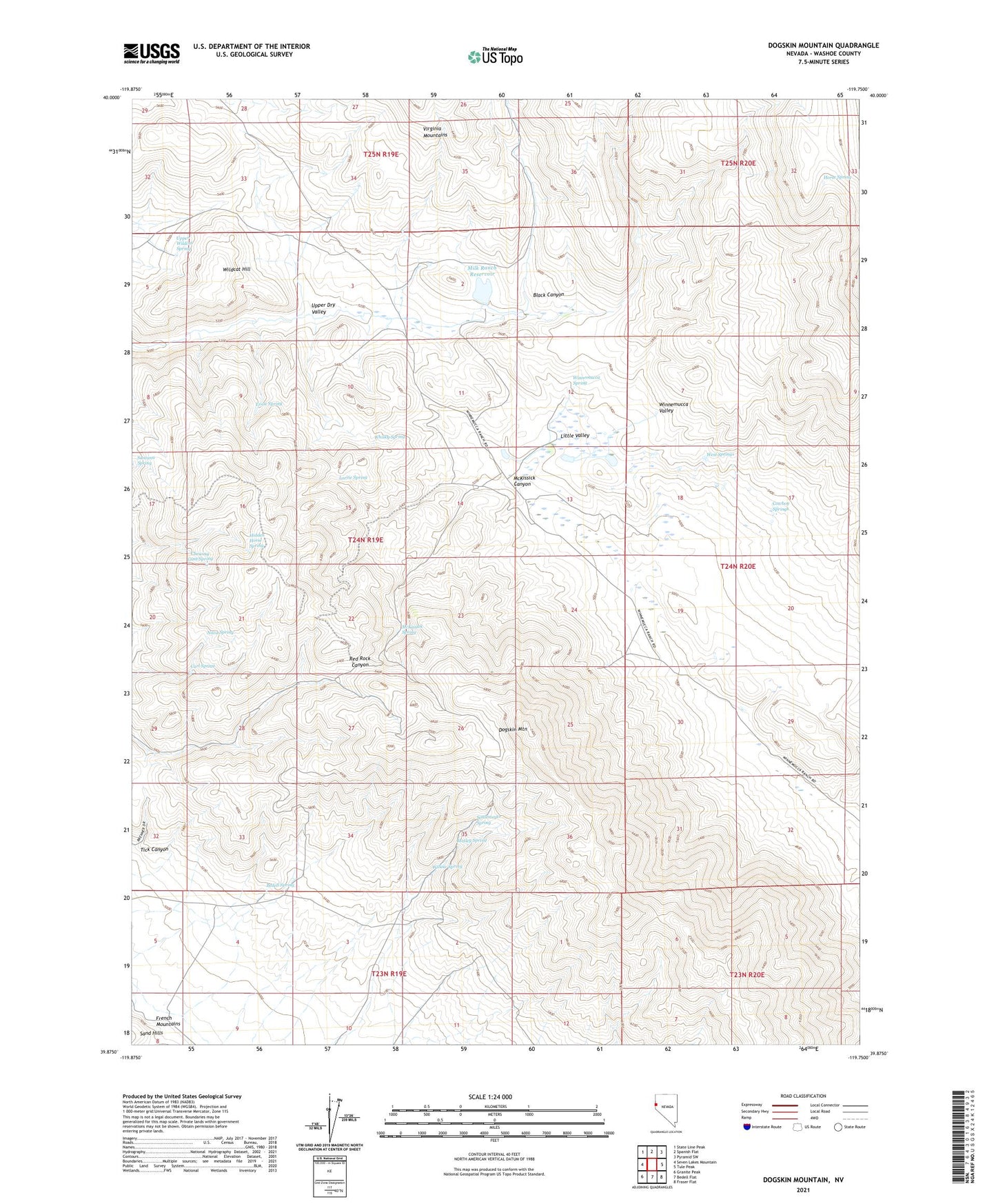
2021 topographic map quadrangle Dogskin Mountain in the state of Nevada. Scale: 1:24000. Based on the newly updated USGS 7.5' US Topo map series, this map is in the following counties: Washoe. The map contains contour data, water features, and other items you are used to seeing on USGS maps, but also has updated roads and other features. This is the next generation of topographic maps. Printed on high-quality waterproof paper with UV fade-resistant inks.
Quads adjacent to this one:
West: Seven Lakes Mountain
Northwest: State Line Peak
North: Spanish Flat
Northeast: Pyramid SW
East: Tule Peak
Southeast: Fraser Flat
South: Bedell Flat
Southwest: Granite Peak
This map covers the same area as the classic USGS quad with code k39119h7.
Contains the following named places: Bedell Spring, Black Canyon, Carl Spring, Chewing Gum Spring, Cowboy Springs, Dogskin Mountain, Ernie Spring, Hidden Horse Spring, Horse Spring, Little Valley, Lorrie Spring, Matley Spring, McKissick Canyon, McKissick Spring, Milk Ranch Dam, Milk Ranch Reservoir, Nava Spring, Santana Spring, Settlemeyer Spring, Tick Canyon, Upper Dry Valley, Upper Wildcat Spring, West Springs, Whisky Spring, Wildcat Hill, Willow Spring, Winnemucca Ranch, Winnemucca Ranch Dam, Winnemucca Ranch Reservoir, Winnemucca Spring