MyTopo
Grass Valley Wash Nevada US Topo Map
Couldn't load pickup availability
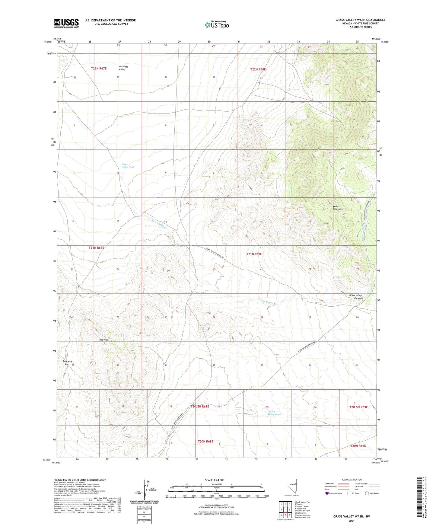
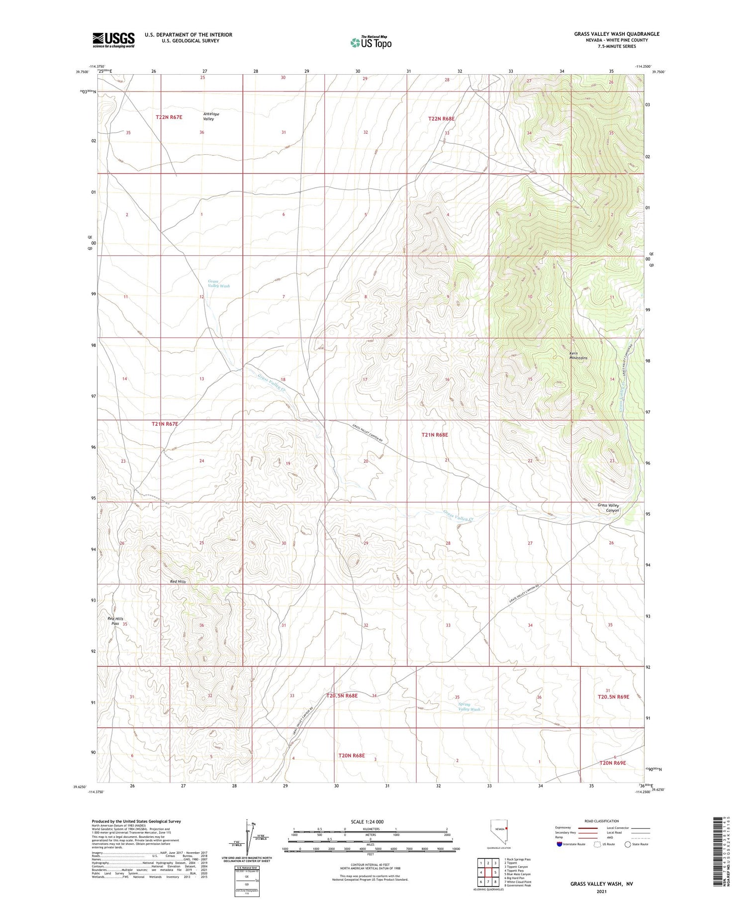
2021 topographic map quadrangle Grass Valley Wash in the state of Nevada. Scale: 1:24000. Based on the newly updated USGS 7.5' US Topo map series, this map is in the following counties: White Pine. The map contains contour data, water features, and other items you are used to seeing on USGS maps, but also has updated roads and other features. This is the next generation of topographic maps. Printed on high-quality waterproof paper with UV fade-resistant inks.
Quads adjacent to this one:
West: Tippett Pass
Northwest: Rock Springs Pass
North: Tippett
Northeast: Tippett Canyon
East: Blue Mass Canyon
Southeast: Government Peak
South: White Cloud Point
Southwest: Big Hard Pan
This map covers the same area as the classic USGS quad with code o39114f3.
Contains the following named places: Grass Valley Canyon, Grass Valley Creek, Grass Valley Wash, Red Hills, Red Hills Mine, Red Hills Pass