MyTopo
Hot Springs Flat Nevada US Topo Map
Couldn't load pickup availability
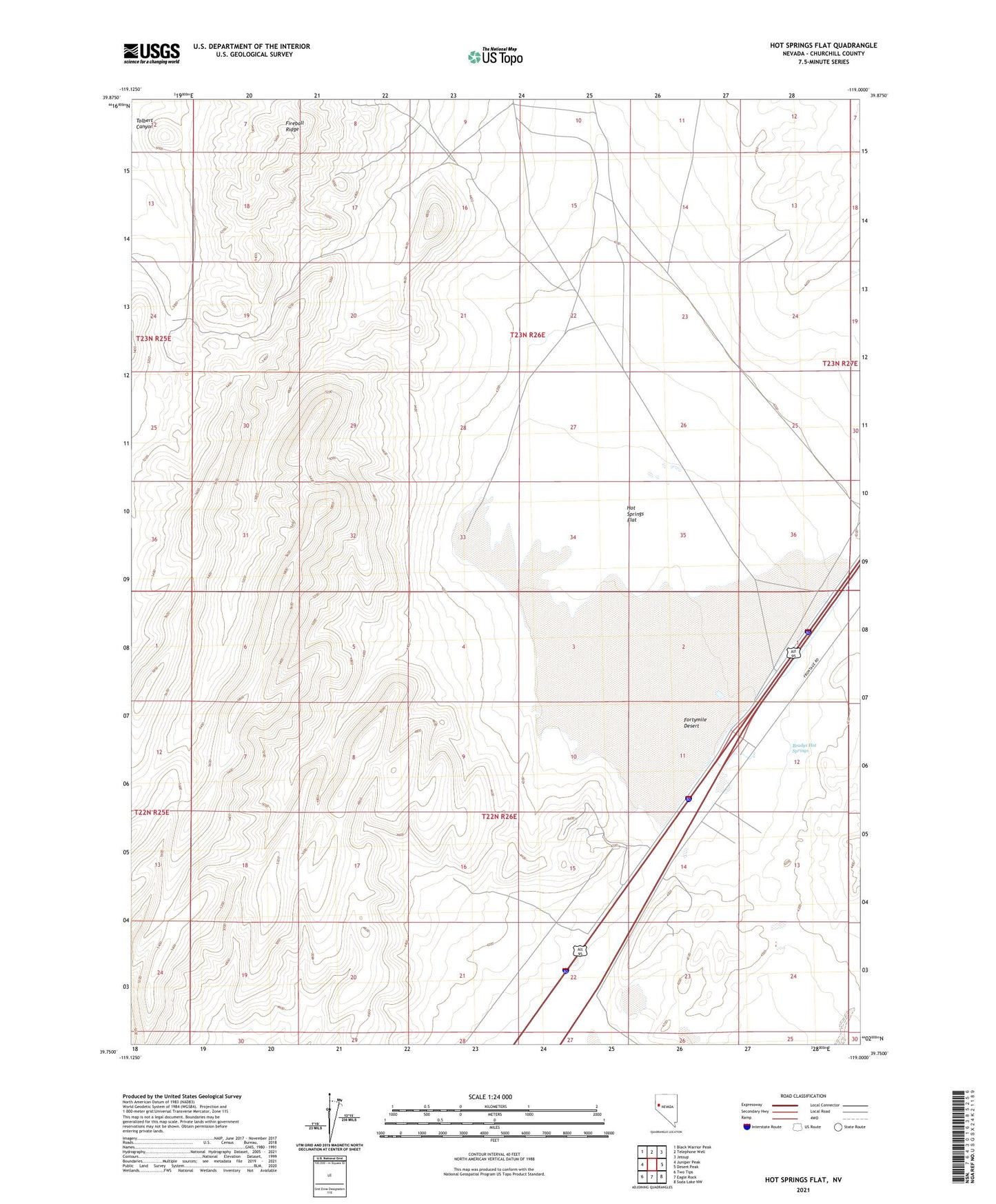
2021 topographic map quadrangle Hot Springs Flat in the state of Nevada. Scale: 1:24000. Based on the newly updated USGS 7.5' US Topo map series, this map is in the following counties: Churchill. The map contains contour data, water features, and other items you are used to seeing on USGS maps, but also has updated roads and other features. This is the next generation of topographic maps. Printed on high-quality waterproof paper with UV fade-resistant inks.
Quads adjacent to this one:
West: Juniper Peak
Northwest: Black Warrior Peak
North: Telephone Well
Northeast: Jessup
East: Desert Peak
Southeast: Soda Lake NW
South: Eagle Rock
Southwest: Two Tips
This map covers the same area as the classic USGS quad with code o39119g1.
Contains the following named places: Bradys Hot Springs, Fireball Ridge, Hot Springs Flat, Massie Post Office, Nezelda Mine, Tolbert Canyon, Truckee Mining District