MyTopo
Hussman Spring Nevada US Topo Map
Couldn't load pickup availability
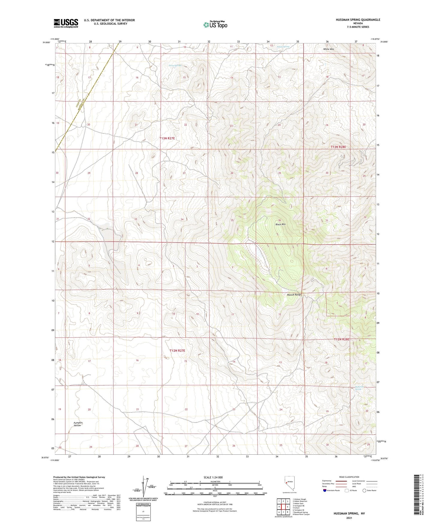
2021 topographic map quadrangle Hussman Spring in the state of Nevada. Scale: 1:24000. Based on the newly updated USGS 7.5' US Topo map series, this map is in the following counties: Mineral, Lyon. The map contains contour data, water features, and other items you are used to seeing on USGS maps, but also has updated roads and other features. This is the next generation of topographic maps. Printed on high-quality waterproof paper with UV fade-resistant inks.
Quads adjacent to this one:
West: Yerington NE
Northwest: Hinkson Slough
North: Weber Reservoir
Northeast: Weber Dam
East: Schurz
Southeast: Reese River Canyon
South: Buckbrush Spring
Southwest: Yerington SE
Contains the following named places: Black Mountain, Black Mountain Dead Man Drift Fence, Black Mountain Well, Granite, Granite Mine, Granite Mining District, Granite Post Office, Hendricks Well, Hussman Spring, Mountain View, Mountain View Mine, Mountain View Post Office, Northern Lights Mine, Paiute Spring, Perry Springs, Yerington Mountain Copper Company Mine