MyTopo
Reese River Canyon Nevada US Topo Map
Couldn't load pickup availability
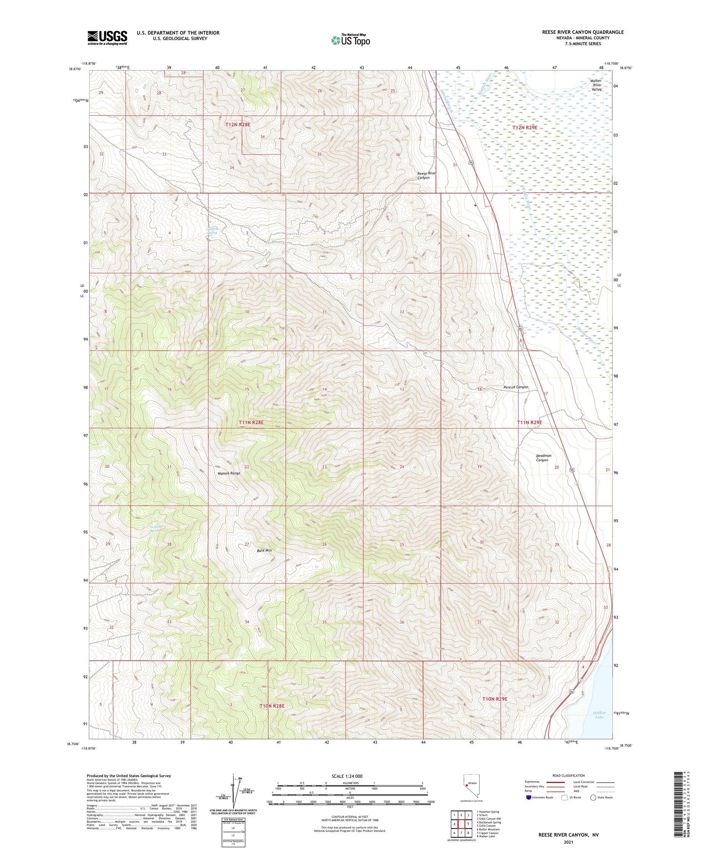
2021 topographic map quadrangle Reese River Canyon in the state of Nevada. Scale: 1:24000. Based on the newly updated USGS 7.5' US Topo map series, this map is in the following counties: Mineral. The map contains contour data, water features, and other items you are used to seeing on USGS maps, but also has updated roads and other features. This is the next generation of topographic maps. Printed on high-quality waterproof paper with UV fade-resistant inks.
Quads adjacent to this one:
West: Buckbrush Spring
Northwest: Hussman Spring
North: Schurz
Northeast: Gillis Canyon NW
East: Gillis Canyon
Southeast: Walker Lake
South: Copper Canyon
Southwest: Butler Mountain
This map covers the same area as the classic USGS quad with code o38118g7.
Contains the following named places: Avalon, Bald Mountain, Cottonwood Spring, Deadman Canyon, Lake Peak, Penrod Canyon, Penrod Mine, Reese River Canyon, Sulphur Spring, Sunny Slope Mine, Twilight Spring