MyTopo
Joe Eason Mountain Nevada US Topo Map
Couldn't load pickup availability
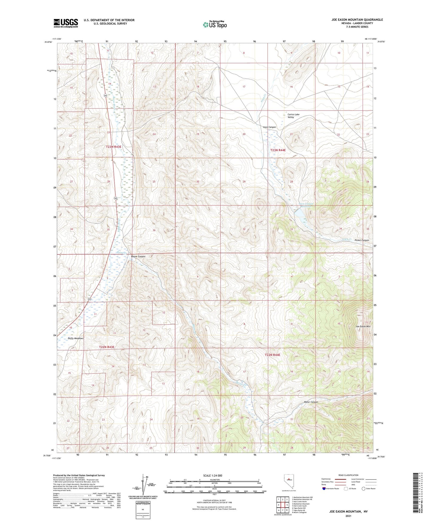
2021 topographic map quadrangle Joe Eason Mountain in the state of Nevada. Scale: 1:24000. Based on the newly updated USGS 7.5' US Topo map series, this map is in the following counties: Lander. The map contains contour data, water features, and other items you are used to seeing on USGS maps, but also has updated roads and other features. This is the next generation of topographic maps. Printed on high-quality waterproof paper with UV fade-resistant inks.
Quads adjacent to this one:
West: Manhattan Mountain
Northwest: Manhattan Mountain NW
North: Manhattan Mountain NE
Northeast: Hall Creek North
East: Hall Creek South
Southeast: Mount Callaghan
South: Vigus Butte NE
Southwest: Vigus Butte NW
Contains the following named places: Boone Canyon, Boone Creek, Boone Creek Ranch, Clarks, Duffy Meadows, Iowa Canyon, Iowa Canyon Ranch, Iowa Canyon Ranches Landing Strip, Iowa Canyon Reservoir, Iowa Canyon School, Iowa Creek Dam, Joe Eason Mountain, Picket Canyon, Vaughn Ranch, Vaughns, Water Canyon