MyTopo
Manhattan Mountain Nevada US Topo Map
Couldn't load pickup availability
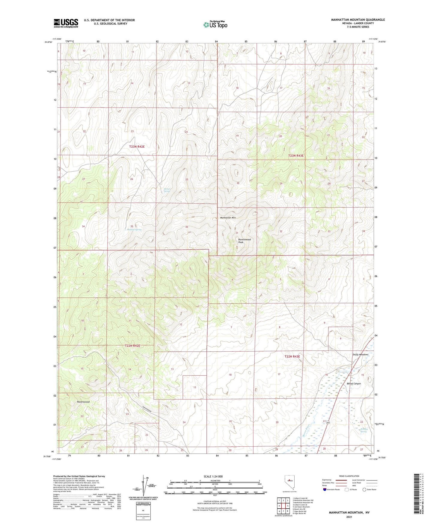
2021 topographic map quadrangle Manhattan Mountain in the state of Nevada. Scale: 1:24000. Based on the newly updated USGS 7.5' US Topo map series, this map is in the following counties: Lander. The map contains contour data, water features, and other items you are used to seeing on USGS maps, but also has updated roads and other features. This is the next generation of topographic maps. Printed on high-quality waterproof paper with UV fade-resistant inks.
Quads adjacent to this one:
West: Gilbert Creek SE
Northwest: Gilbert Creek NE
North: Manhattan Mountain NW
Northeast: Manhattan Mountain NE
East: Joe Eason Mountain
Southeast: Vigus Butte NE
South: Vigus Butte NW
Southwest: Mount Airy NE
This map covers the same area as the classic USGS quad with code o39117g2.
Contains the following named places: Bernd Canyon, Bradley Spring, Manhattan Mountain, Meadow Spring, Mitchels Ranch, Rast Mine, Ravenswood Mining District, Ravenswood Peak, Steiner Spring