MyTopo
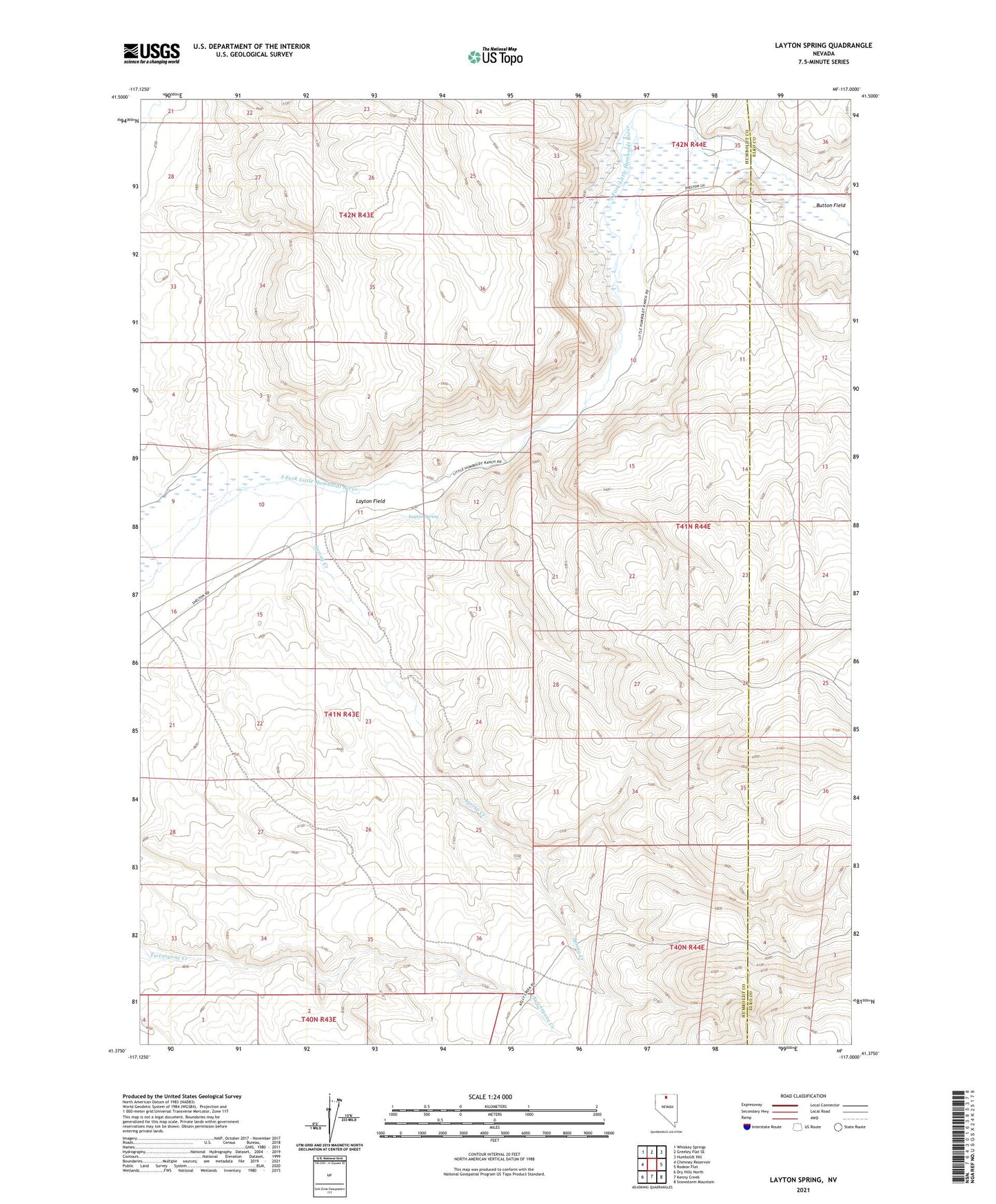
Layton Spring Nevada US Topo Map
Couldn't load pickup availability
2021 topographic map quadrangle Layton Spring in the state of Nevada. Scale: 1:24000. Based on the newly updated USGS 7.5' US Topo map series, this map is in the following counties: Humboldt, Elko. The map contains contour data, water features, and other items you are used to seeing on USGS maps, but also has updated roads and other features. This is the next generation of topographic maps. Printed on high-quality waterproof paper with UV fade-resistant inks.
Quads adjacent to this one:
West: Chimney Reservoir
Northwest: Whiskey Springs
North: Greeley Flat SE
Northeast: Humboldt Hill
East: Rodear Flat
Southeast: Snowstorm Mountain
South: Kenny Creek
Southwest: Dry Hills North
This map covers the same area as the classic USGS quad with code o41117d1.
Contains the following named places: Button Field, Buttons Post Office, Latons Spring Dam Site, Layton Field, Layton Spring, Little Humboldt Ranch, Milligan Creek, Spring Creek