MyTopo
Logan Peak Nevada US Topo Map
Couldn't load pickup availability
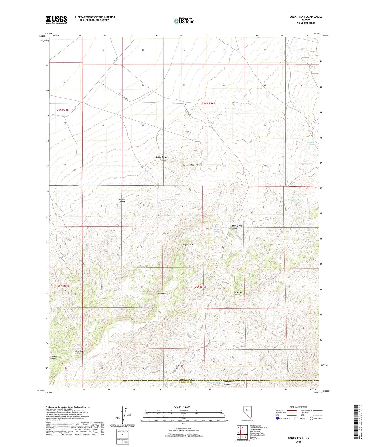
2021 topographic map quadrangle Logan Peak in the state of Nevada. Scale: 1:24000. Based on the newly updated USGS 7.5' US Topo map series, this map is in the following counties: Pershing, Churchill. The map contains contour data, water features, and other items you are used to seeing on USGS maps, but also has updated roads and other features. This is the next generation of topographic maps. Printed on high-quality waterproof paper with UV fade-resistant inks.
Quads adjacent to this one:
West: Cornish Peak
Northwest: Fisher Canyon
North: West of McKinney Pass
Northeast: McKinney Pass
East: Fencemaker Pass
Southeast: Boyer Ranch
South: Bolivia
Southwest: Dixie Hot Springs NE
Contains the following named places: Band M Mine, Big Ben Canyon, Buena Vista Windmill, Fencemaker Camp, Freckles Mine, Hot Spring, Kitten Springs, Kitten Springs Canyon, Logan Canyon, Logan Peak, Logan Spring, Mustang Spring, Red Hill, Storm Mine, Table Mountain, Table Mountain Mining District, Victory Mine