MyTopo
McKinney Pass Nevada US Topo Map
Couldn't load pickup availability
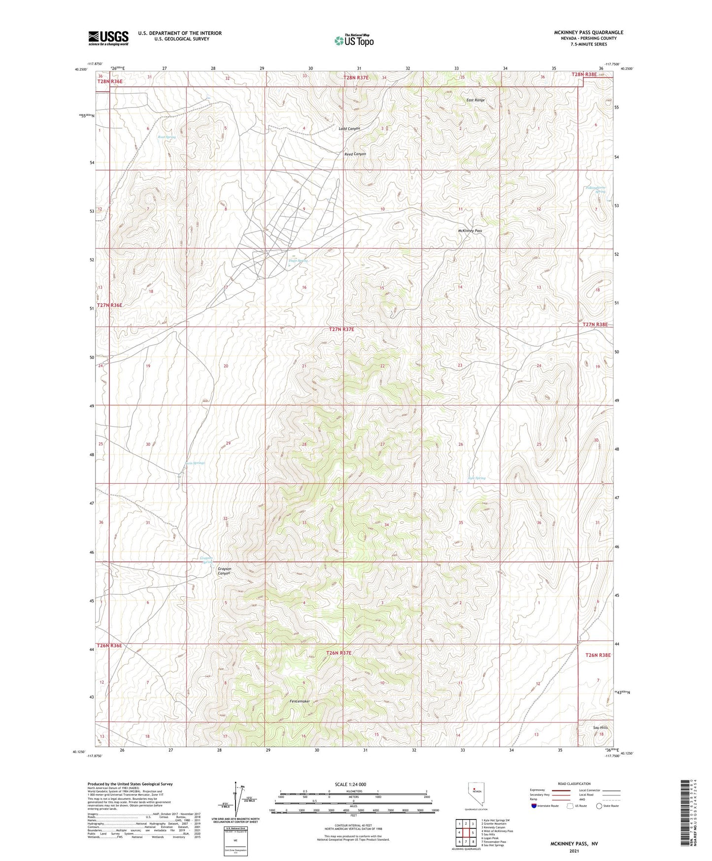
2021 topographic map quadrangle McKinney Pass in the state of Nevada. Scale: 1:24000. Based on the newly updated USGS 7.5' US Topo map series, this map is in the following counties: Pershing. The map contains contour data, water features, and other items you are used to seeing on USGS maps, but also has updated roads and other features. This is the next generation of topographic maps. Printed on high-quality waterproof paper with UV fade-resistant inks.
Quads adjacent to this one:
West: West of McKinney Pass
Northwest: Kyle Hot Springs SW
North: Granite Mountain
Northeast: Kennedy Canyon
East: Sou Hills
Southeast: Sou Hot Springs
South: Fencemaker Pass
Southwest: Logan Peak
This map covers the same area as the classic USGS quad with code o40117b7.
Contains the following named places: Dago Spring, Grayson Canyon, Grayson Spring, Kyle Spring, Ladd Canyon, McKinney Pass, Pleasant Valley Beacon, Polkinghorne Spring, Reed Canyon, Ringling Ranch, Root Spring, Twin Springs