MyTopo
Loomis Mountain Nevada US Topo Map
Couldn't load pickup availability
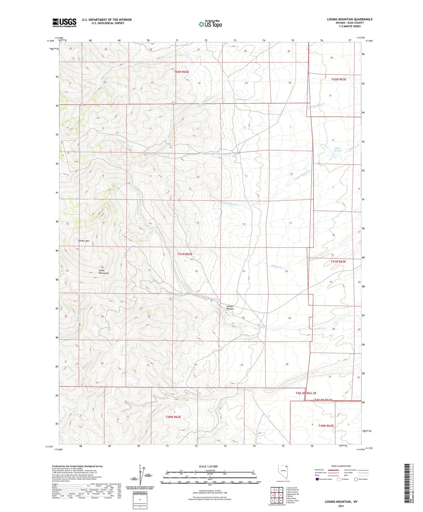
2021 topographic map quadrangle Loomis Mountain in the state of Nevada. Scale: 1:24000. Based on the newly updated USGS 7.5' US Topo map series, this map is in the following counties: Elko. The map contains contour data, water features, and other items you are used to seeing on USGS maps, but also has updated roads and other features. This is the next generation of topographic maps. Printed on high-quality waterproof paper with UV fade-resistant inks.
Quads adjacent to this one:
West: Black Butte NE
Northwest: Stormy Peak
North: Boies Reservoir
Northeast: Harris Canyon
East: Wilkins
Southeast: Melandco
South: Summer Camp
Southwest: Black Butte
This map covers the same area as the classic USGS quad with code o41114d8.
Contains the following named places: Cold Spring, Loomis Mountain, Loomis Pasture, North Fork Willow Creek, Schoer Place, South Fork Willow Creek, Willow Springs