MyTopo
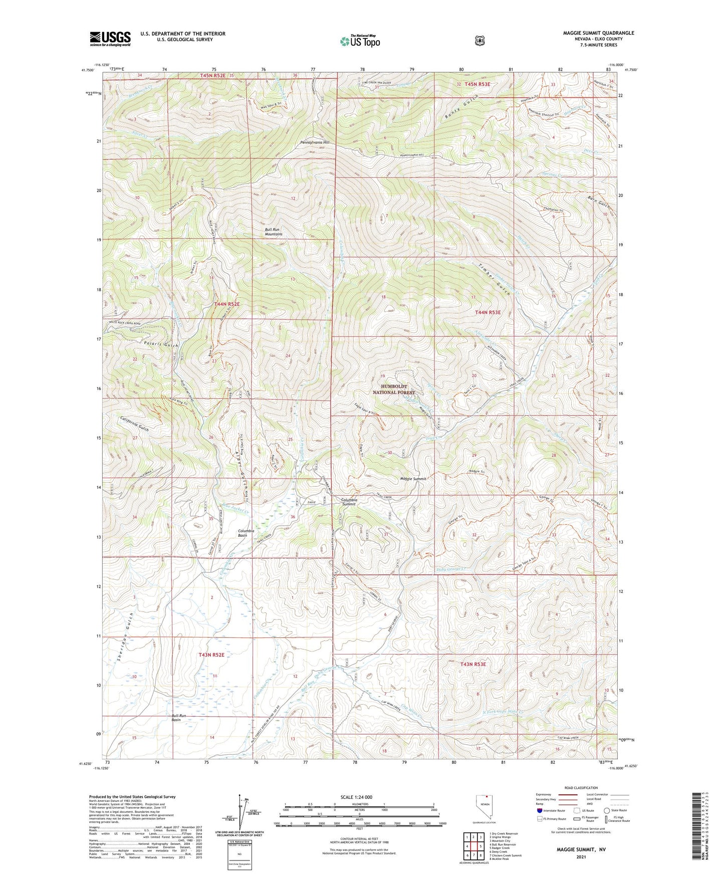
Maggie Summit Nevada US Topo Map
Couldn't load pickup availability
Also explore the Maggie Summit Forest Service Topo of this same quad for updated USFS data
2021 topographic map quadrangle Maggie Summit in the state of Nevada. Scale: 1:24000. Based on the newly updated USGS 7.5' US Topo map series, this map is in the following counties: Elko. The map contains contour data, water features, and other items you are used to seeing on USGS maps, but also has updated roads and other features. This is the next generation of topographic maps. Printed on high-quality waterproof paper with UV fade-resistant inks.
Quads adjacent to this one:
West: Bull Run Reservoir
Northwest: Dry Creek Reservoir
North: Ungina Wongo
Northeast: Mountain City
East: Badger Creek
Southeast: McAfee Peak
South: Chicken Creek Summit
Southwest: Deep Creek
This map covers the same area as the classic USGS quad with code o41116f1.
Contains the following named places: Alder Gulch, Alexander Creek, Aura, Aura King Mine, Aura Mining District, Aura Post Office, Big Four Mine, Blue Jacket Creek, Bull Run Basin, California Gulch, Cap Winn Creek, Central Pacific Mine, Columbia, Columbia Basin, Columbia Creek, Columbia Post Office, Columbia Queen Mine, Columbia Ranch, Columbia Summit, Doby George Creek, Golden Eagle Mine, H Ireland Ranch, Humboldt Mine, Hutch Creek, Infidel Mine, Maggie Gulch, Maggie Gulch Creek, Maggie Summit, North Fork Cap Winn Creek, Pennsylvania Hill, Polaris Gulch, Polaris Mine, Porter Mine, Sheep Creek, Spring Creek, Timber Gulch, Timber Gulch Creek, Town Treasure Mine, Twin Creek, ZIP Code: 89831