MyTopo
Magruder Mountain Nevada US Topo Map
Couldn't load pickup availability
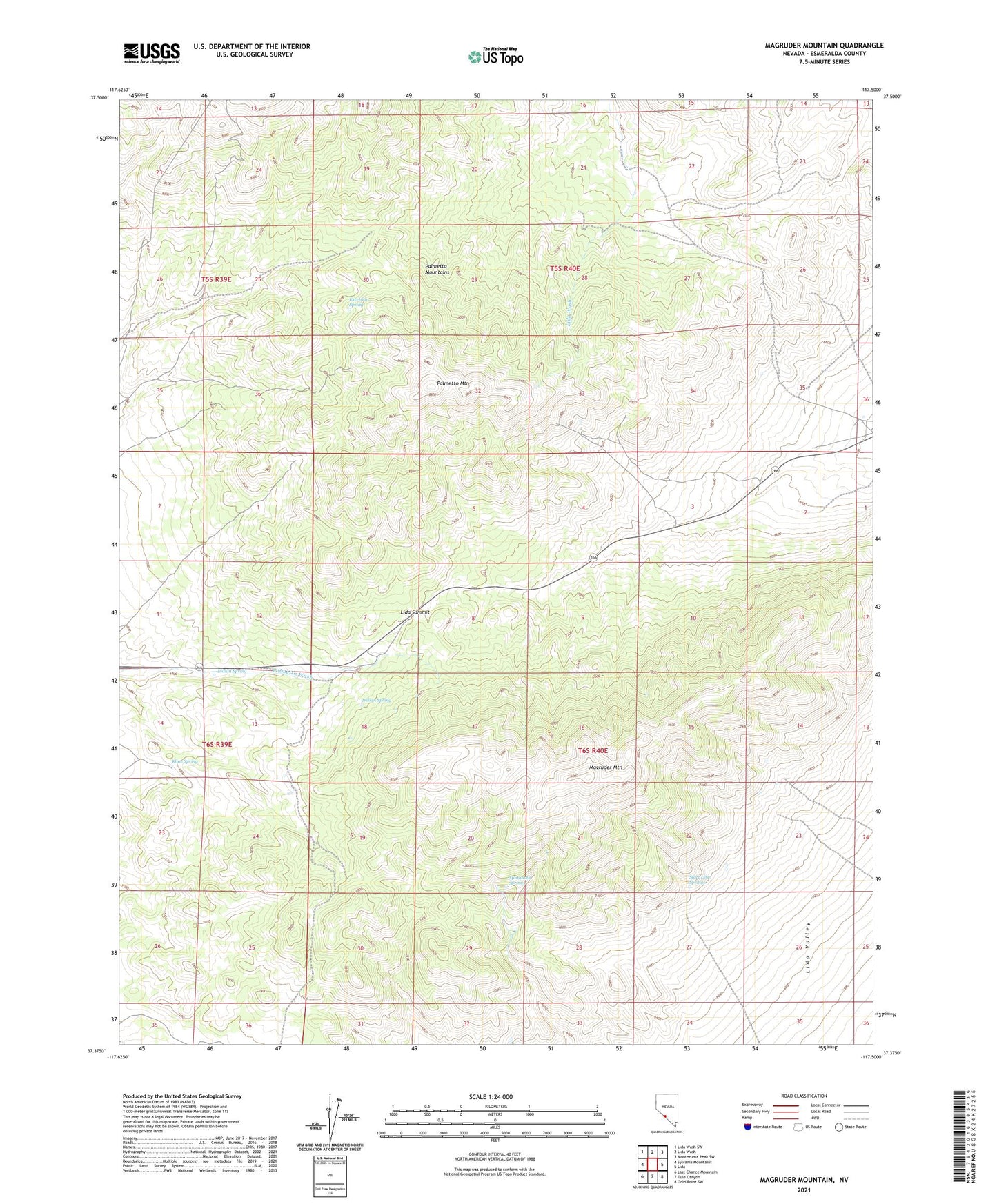
2021 topographic map quadrangle Magruder Mountain in the state of Nevada. Scale: 1:24000. Based on the newly updated USGS 7.5' US Topo map series, this map is in the following counties: Esmeralda. The map contains contour data, water features, and other items you are used to seeing on USGS maps, but also has updated roads and other features. This is the next generation of topographic maps. Printed on high-quality waterproof paper with UV fade-resistant inks.
Quads adjacent to this one:
West: Sylvania Mountains
Northwest: Lida Wash SW
North: Lida Wash
Northeast: Montezuma Peak SW
East: Lida
Southeast: Gold Point SW
South: Tule Canyon
Southwest: Last Chance Mountain
Contains the following named places: Blue Dick Mine, Buster Mine, Champion Mine, Excelsior Spring, Indian Spring, Kentucky Mine, Kline Spring, Lida Summit, Magruder Mountain, Mammoth Springs, Mattmueller Mine, Nevada Silver State Mine, New York Mine, Palmetto Mining District, Palmetto Mountain, Palmetto Mountains, State Line Springs, Virginia Mine