MyTopo
Lida Nevada US Topo Map
Couldn't load pickup availability
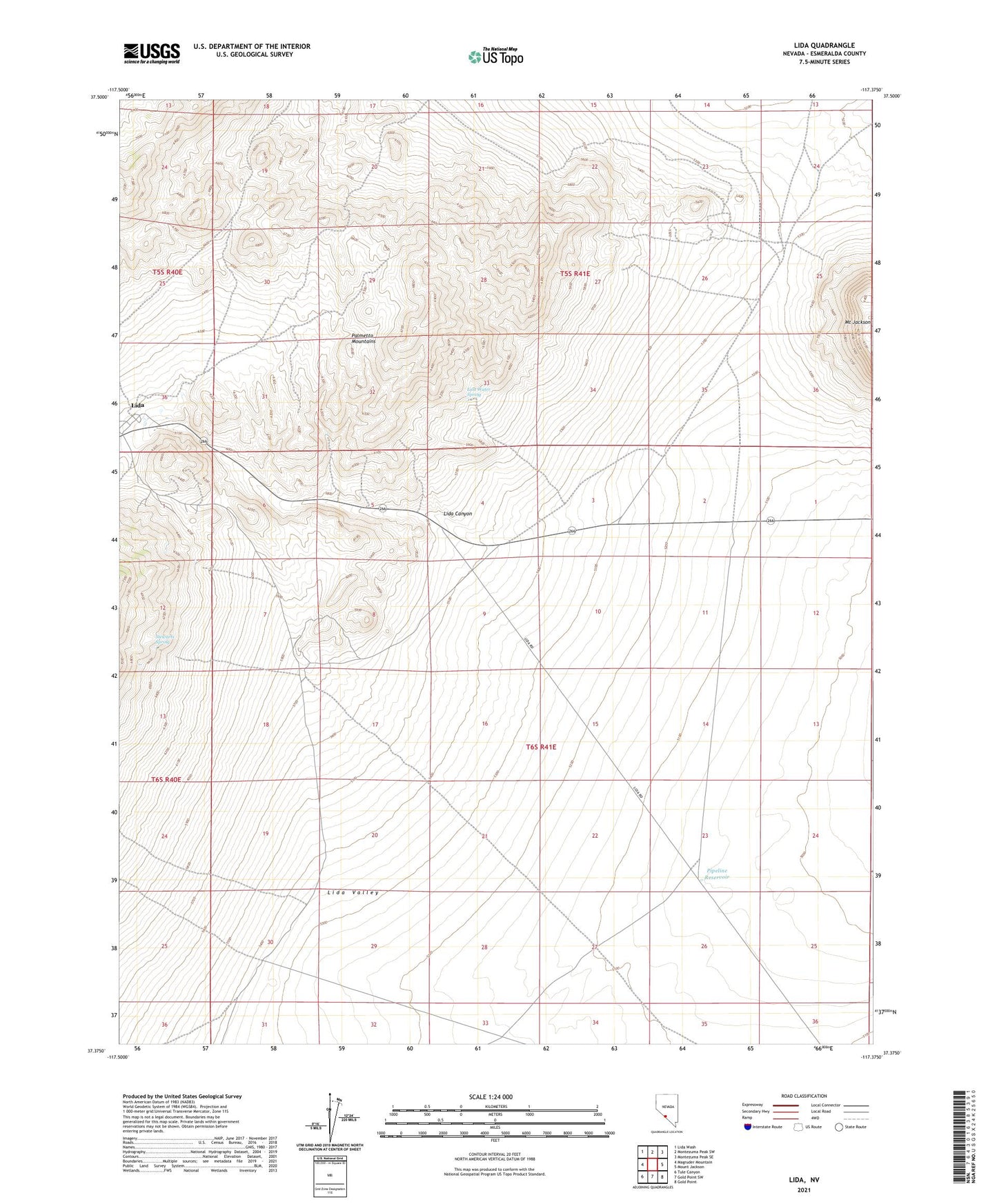
2021 topographic map quadrangle Lida in the state of Nevada. Scale: 1:24000. Based on the newly updated USGS 7.5' US Topo map series, this map is in the following counties: Esmeralda. The map contains contour data, water features, and other items you are used to seeing on USGS maps, but also has updated roads and other features. This is the next generation of topographic maps. Printed on high-quality waterproof paper with UV fade-resistant inks.
Quads adjacent to this one:
West: Magruder Mountain
Northwest: Lida Wash
North: Montezuma Peak SW
Northeast: Montezuma Peak SE
East: Mount Jackson
Southeast: Gold Point
South: Gold Point SW
Southwest: Tule Canyon
This map covers the same area as the classic USGS quad with code o37117d4.
Contains the following named places: Ingalls Mine, Last Water Spring, Lida, Lida Canyon, Lida Mining District, Lida Post Office, Mount Jackson, Pipeline Reservoir, Pipers Toll Road, Stewarts Mill, Stewarts Spring, Timbi-Sha Shoshone Reservation