MyTopo
McTarnahan Hill Nevada US Topo Map
Couldn't load pickup availability
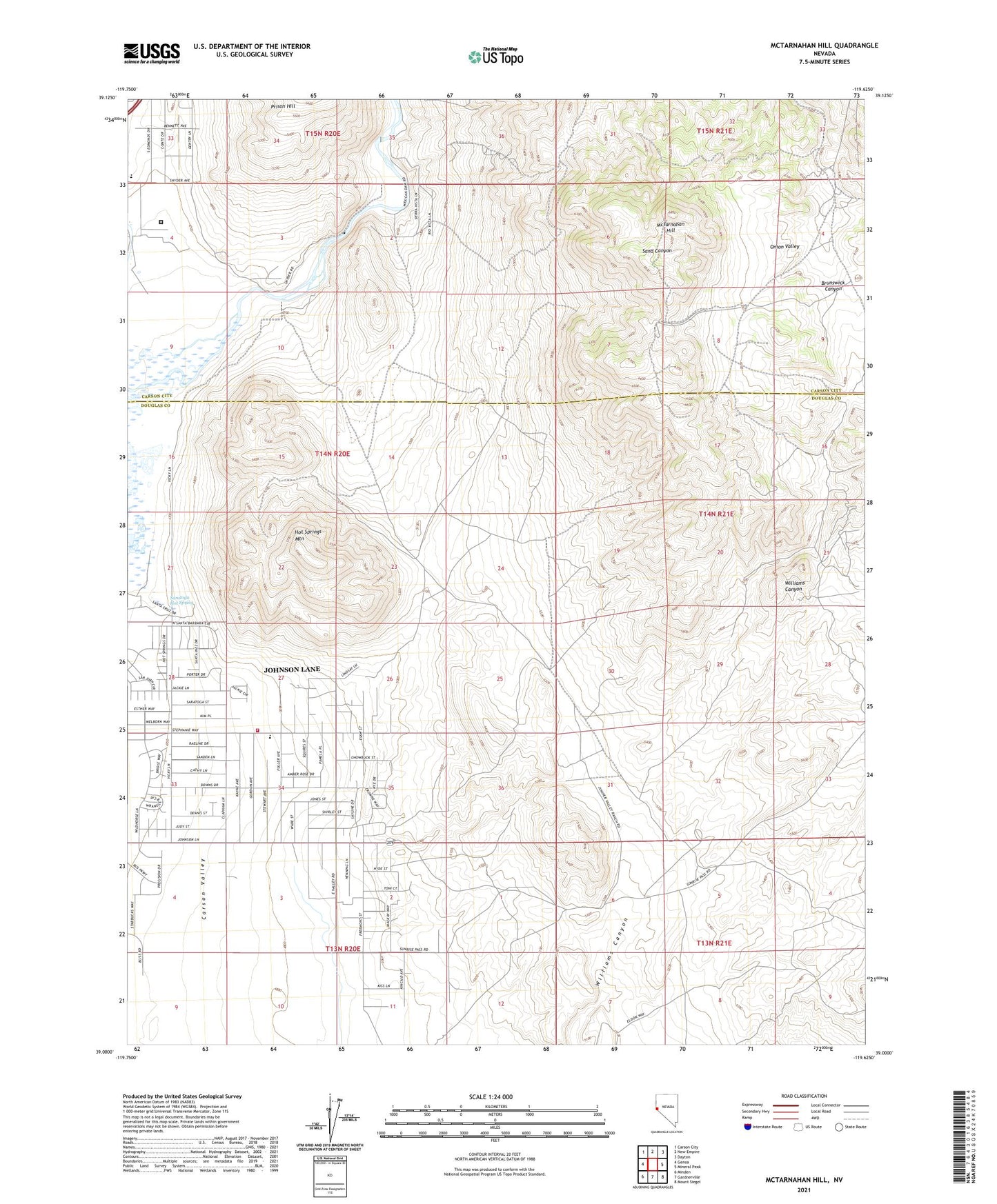
2021 topographic map quadrangle McTarnahan Hill in the state of Nevada. Scale: 1:24000. Based on the newly updated USGS 7.5' US Topo map series, this map is in the following counties: Douglas, Carson City (city). The map contains contour data, water features, and other items you are used to seeing on USGS maps, but also has updated roads and other features. This is the next generation of topographic maps. Printed on high-quality waterproof paper with UV fade-resistant inks.
Quads adjacent to this one:
West: Genoa
Northwest: Carson City
North: New Empire
Northeast: Dayton
East: Mineral Peak
Southeast: Mount Siegel
South: Gardnerville
Southwest: Minden
Contains the following named places: Alex Eske Mine, Buckbrush Well, Bunker Hill Mine, Capitol Mine, Clear Creek, Delaware Mining District, East Fork Fire and Paramedic Districts Station 6 Johnson Lane Volunteer Fire Department, Hot Springs Mountain, Johnson Lane, Johnson Lane Census Designated Place, McTarnahan Bridge, McTarnahan Hill, Mexican Dam, Northern Nevada Correctional Center, Onion Valley, Pinon Hills Elementary School, Quilici Dam, Saratoga Hot Spring, Smith Brothers Mine, Stewart Smoke Stack, United Mining Company Mine, Valley View Mine, Williams Canyon Well, Yerington Mine