MyTopo
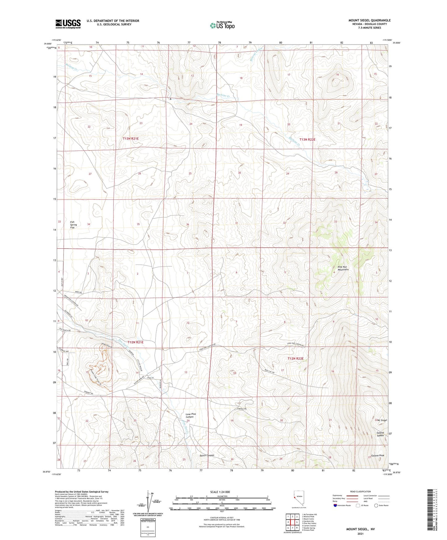
Mount Siegel Nevada US Topo Map
Couldn't load pickup availability
Also explore the Mount Siegel Forest Service Topo of this same quad for updated USFS data
2021 topographic map quadrangle Mount Siegel in the state of Nevada. Scale: 1:24000. Based on the newly updated USGS 7.5' US Topo map series, this map is in the following counties: Douglas. The map contains contour data, water features, and other items you are used to seeing on USGS maps, but also has updated roads and other features. This is the next generation of topographic maps. Printed on high-quality waterproof paper with UV fade-resistant inks.
Quads adjacent to this one:
West: Gardnerville
Northwest: McTarnahan Hill
North: Mineral Peak
Northeast: Mount Como
East: Pine Nut Valley
Southeast: Oreana Peak
South: Double Spring
Southwest: Carters Station
This map covers the same area as the classic USGS quad with code o38119h5.
Contains the following named places: Bill Johnsons Ranch, Cherokee Mine, Divide Mine, Douglas County, Dutch Canyon, Galena Peak, Galena Saddle, Gardnerville Mining District, Last Laugh Mine, Lone Pine Canyon, Monarch Mine, Mount Siegel, Pine Nut Ranch, Smith Ranch, Tungsten Hills Mine, Uhaldi Well