MyTopo
Mount Annie Nevada US Topo Map
Couldn't load pickup availability
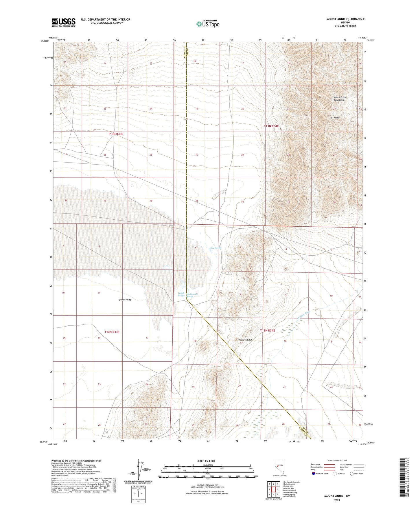
2021 topographic map quadrangle Mount Annie in the state of Nevada. Scale: 1:24000. Based on the newly updated USGS 7.5' US Topo map series, this map is in the following counties: Mineral, Nye. The map contains contour data, water features, and other items you are used to seeing on USGS maps, but also has updated roads and other features. This is the next generation of topographic maps. Printed on high-quality waterproof paper with UV fade-resistant inks.
Quads adjacent to this one:
West: Murphys Well
Northwest: Big Kasock Mountain
North: Slate Mountain
Northeast: Broken Hills
East: Mount Annie NE
Southeast: Mount Annie SE
South: Ramsey Spring
Southwest: Poinsettia Spring
Contains the following named places: Cold Springs, Fissure Ridge, Lower Phillips Well, Mecca, Monte Cristo, Monte Cristo Mountains, Mount Annie, Mud Windmill, Phillips Wash, Rawhide Hot Springs, Wedell Springs, Woodruff Post Office, Woodruffs