
MyTopo
Ramsey Spring Nevada US Topo Map
Couldn't load pickup availability
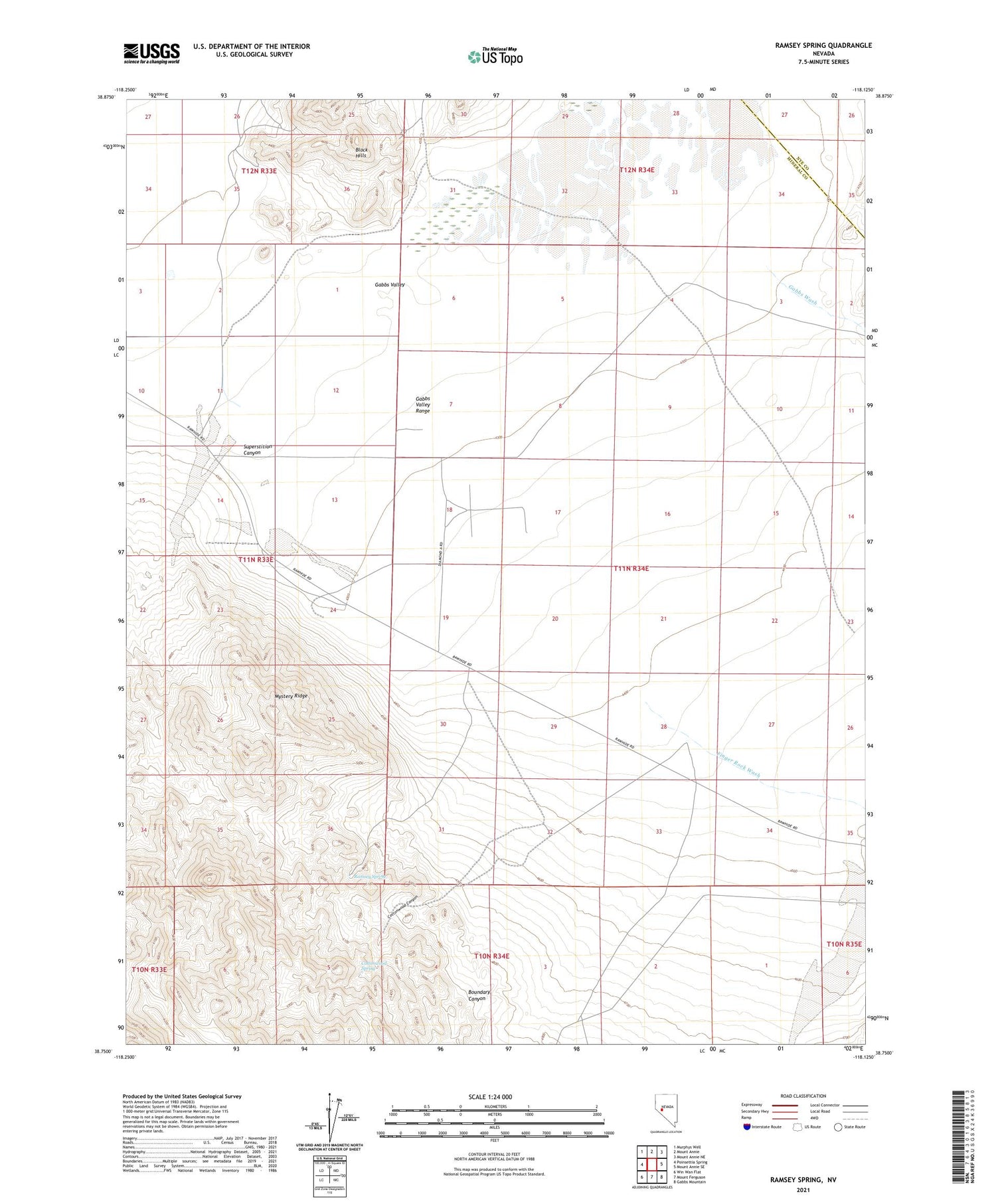
2021 topographic map quadrangle Ramsey Spring in the state of Nevada. Scale: 1:24000. Based on the newly updated USGS 7.5' US Topo map series, this map is in the following counties: Mineral, Nye. The map contains contour data, water features, and other items you are used to seeing on USGS maps, but also has updated roads and other features. This is the next generation of topographic maps. Printed on high-quality waterproof paper with UV fade-resistant inks.
Quads adjacent to this one:
West: Poinsettia Spring
Northwest: Murphys Well
North: Mount Annie
Northeast: Mount Annie NE
East: Mount Annie SE
Southeast: Gabbs Mountain
South: Mount Ferguson
Southwest: Win Wan Flat
This map covers the same area as the classic USGS quad with code o38118g2.
Contains the following named places: Black Hills, Boundary Canyon, Cottonwood Canyon, Cottonwood Spring, Finger Rock Wash, Finger Rock Well Number 1, Gabbs Valley, Lithia Mine, Mystery Ridge, Ramsey Spring, Rita Mine, Rovada Mining Company Mine, Superstition Canyon, Warrens Well


