MyTopo
Mount Grafton Nevada US Topo Map
Couldn't load pickup availability
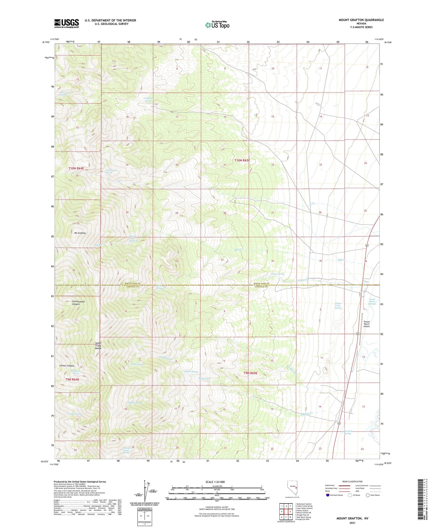
2021 topographic map quadrangle Mount Grafton in the state of Nevada. Scale: 1:24000. Based on the newly updated USGS 7.5' US Topo map series, this map is in the following counties: White Pine, Lincoln. The map contains contour data, water features, and other items you are used to seeing on USGS maps, but also has updated roads and other features. This is the next generation of topographic maps. Printed on high-quality waterproof paper with UV fade-resistant inks.
Quads adjacent to this one:
West: Parker Station
Northwest: Bullwhack Summit
North: Cattle Camp Spring
Northeast: Lake Valley Summit
East: Mount Grafton NE
Southeast: Gouge Eye Well
South: Milk Ranch Spring
Southwest: Shingle Pass SE
Contains the following named places: Campbell Spring, Canyon Spring, Deer Track Spring, Deer Trail Mine, Dupont Creek, Dupont Spring, Geyser, Geyser Creek, Geyser Creek Spring, Geyser Maintenance Station, Geyser Mine, Geyser Post Office, Geyser Ranch, Geyser Ranch Airport, Geyser Ranch Mining Area, Geyser Ranch Springs, Geyser Spring, Graham Spring, Lake Valley, Mahogany Spring, Mill Creek, Mill Creek Spring, Mount Grafton, Mount Grafton Scenic Area, Mount Grafton Wilderness, North Creek, North Creek Spring, North Eldridge Well, Quaker Spring, Schwartz Tunnel Spring, Sheep Creek, Sheep Creek Spring, Wambolt Creek, Wambolt Springs