MyTopo
New York Peak Nevada US Topo Map
Couldn't load pickup availability
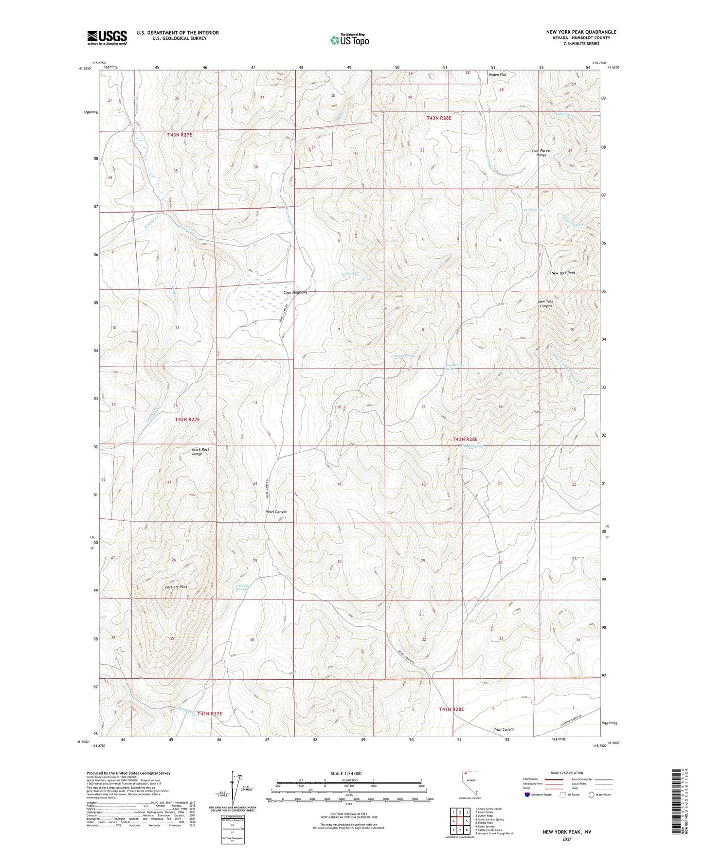
2021 topographic map quadrangle New York Peak in the state of Nevada. Scale: 1:24000. Based on the newly updated USGS 7.5' US Topo map series, this map is in the following counties: Humboldt. The map contains contour data, water features, and other items you are used to seeing on USGS maps, but also has updated roads and other features. This is the next generation of topographic maps. Printed on high-quality waterproof paper with UV fade-resistant inks.
Quads adjacent to this one:
West: Idaho Canyon Spring
Northwest: Knott Creek Ranch
North: Knott Creek
Northeast: Duffer Peak
East: Bishop Peak
Southeast: Leonard Creek Slough North
South: Battle Creek Ranch
Southwest: Burnt Springs
This map covers the same area as the classic USGS quad with code o41118e7.
Contains the following named places: Bartlett Mine, Bartlett Peak, Center Creek, Columbia Mine, Corral Creek, Corral Spring, Cove Camp, Cove Creek, Cove Meadow Mine, Cove Meadow Mining District, Cove Meadows, Josie Pearl Spring, Juanita Mine, Lone Meadow Spring, McCully Cabin, New York Peak, Pearl Camp, Summit Lake Division, Trail Canyon, Trough Spring, Willow Spring