MyTopo
North Peak Nevada US Topo Map
Couldn't load pickup availability
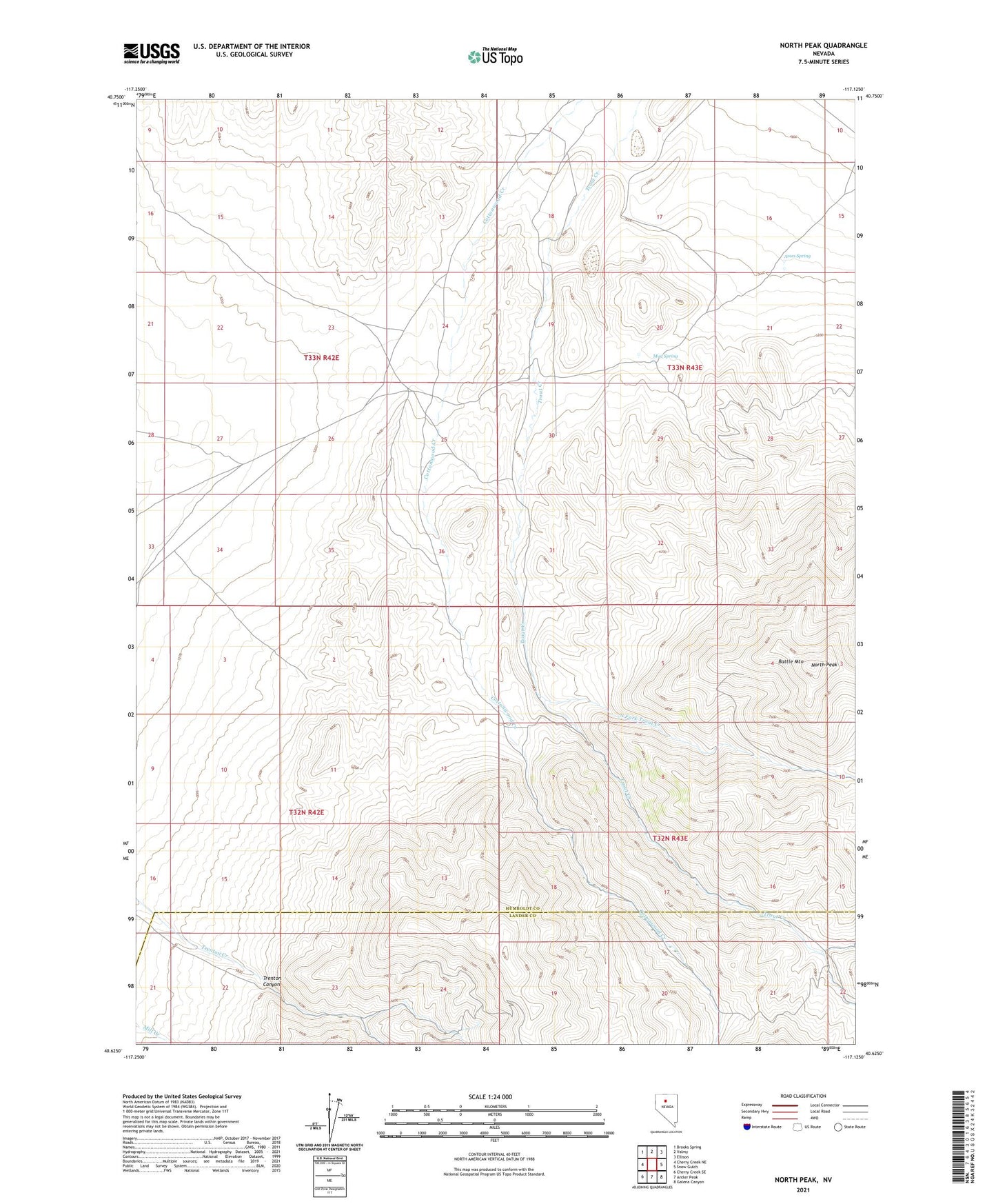
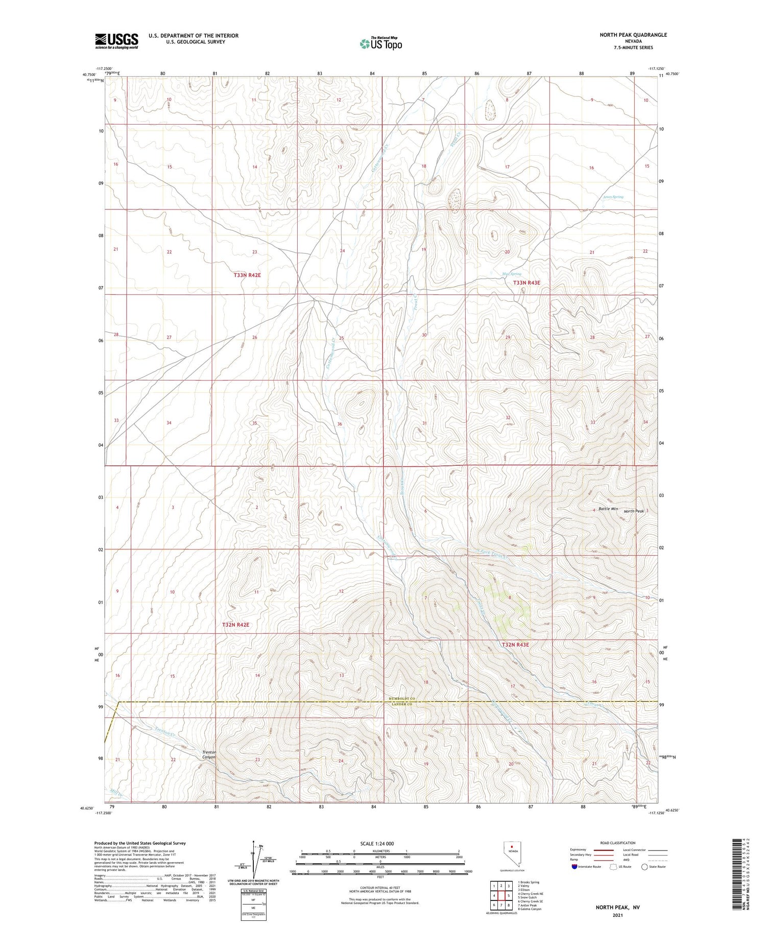
2021 topographic map quadrangle North Peak in the state of Nevada. Scale: 1:24000. Based on the newly updated USGS 7.5' US Topo map series, this map is in the following counties: Humboldt, Lander. The map contains contour data, water features, and other items you are used to seeing on USGS maps, but also has updated roads and other features. This is the next generation of topographic maps. Printed on high-quality waterproof paper with UV fade-resistant inks.
Quads adjacent to this one:
West: Cherry Creek NE
Northwest: Brooks Spring
North: Valmy
Northeast: Ellison
East: Snow Gulch
Southeast: Galena Canyon
South: Antler Peak
Southwest: Cherry Creek SE
Contains the following named places: Ames Spring, Battle Mountain, Marigold Mine, Mud Spring, North Fork Trout Creek, North Peak, Oyarbide Ranch, Trenton Canyon