MyTopo
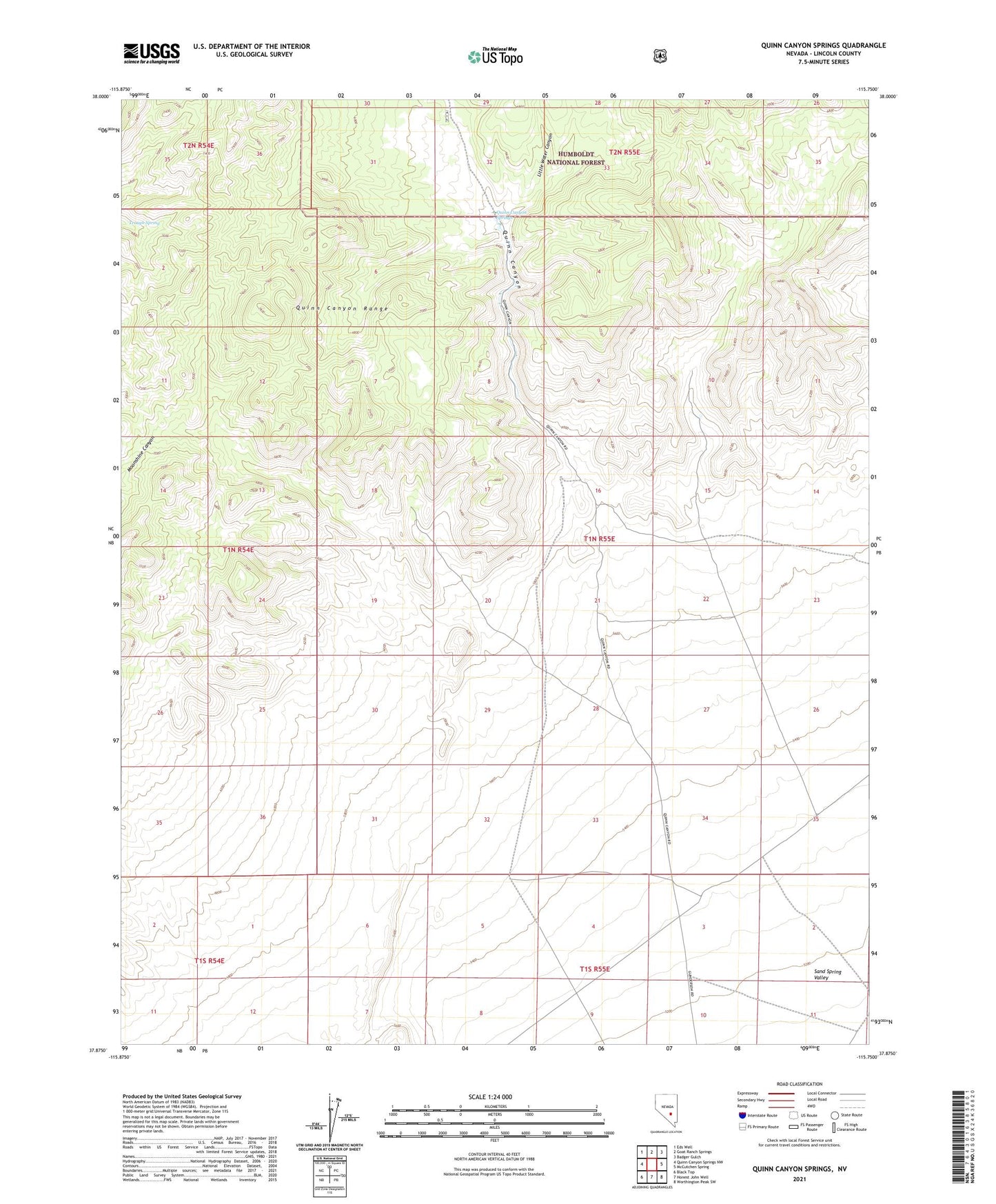
Quinn Canyon Springs Nevada US Topo Map
Couldn't load pickup availability
Also explore the Quinn Canyon Springs Forest Service Topo of this same quad for updated USFS data
2021 topographic map quadrangle Quinn Canyon Springs in the state of Nevada. Scale: 1:24000. Based on the newly updated USGS 7.5' US Topo map series, this map is in the following counties: Lincoln. The map contains contour data, water features, and other items you are used to seeing on USGS maps, but also has updated roads and other features. This is the next generation of topographic maps. Printed on high-quality waterproof paper with UV fade-resistant inks.
Quads adjacent to this one:
West: Quinn Canyon Springs NW
Northwest: Eds Well
North: Goat Ranch Springs
Northeast: Badger Gulch
East: McCutchen Spring
Southeast: Worthington Peak SW
South: Honest John Well
Southwest: Black Top
This map covers the same area as the classic USGS quad with code o37115h7.
Contains the following named places: Little Water Canyon, Quinn Canyon, Quinn Canyon Springs, Stewart Quarry, Trough Spring