MyTopo
Rawhide Nevada US Topo Map
Couldn't load pickup availability
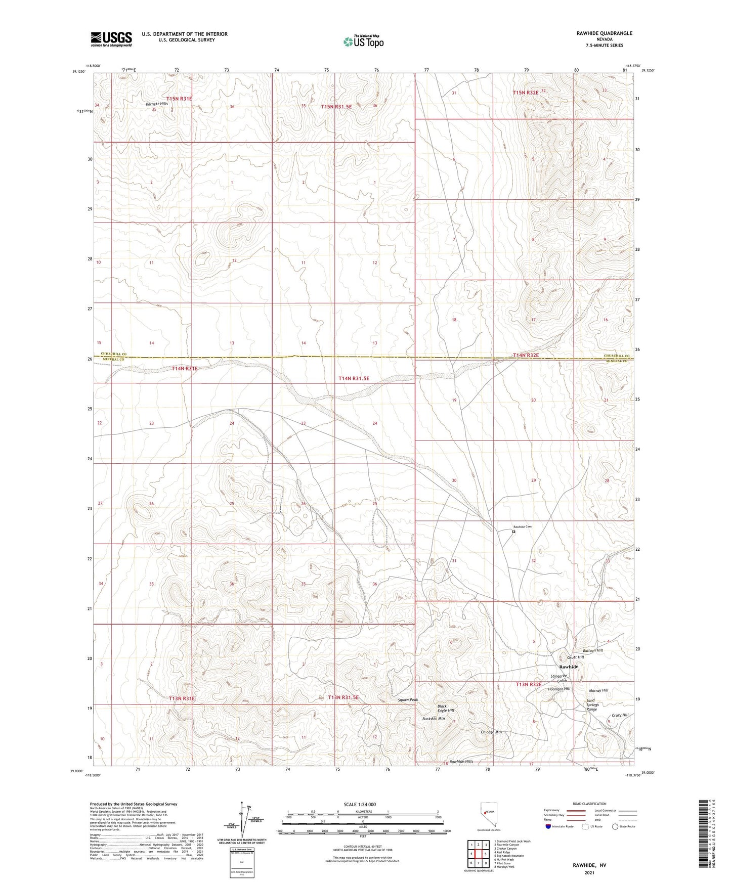
2021 topographic map quadrangle Rawhide in the state of Nevada. Scale: 1:24000. Based on the newly updated USGS 7.5' US Topo map series, this map is in the following counties: Mineral, Churchill. The map contains contour data, water features, and other items you are used to seeing on USGS maps, but also has updated roads and other features. This is the next generation of topographic maps. Printed on high-quality waterproof paper with UV fade-resistant inks.
Quads adjacent to this one:
West: Red Ridge
Northwest: Diamond Field Jack Wash
North: Fourmile Canyon
Northeast: Chukar Canyon
East: Big Kasock Mountain
Southeast: Murphys Well
South: Pilot Cone
Southwest: Hu-Pwi Wash
Contains the following named places: Balloon Hill, Bethania Mine, Black Eagle Hill, Black Eagle Mine, Buckskin Mountain, Bullskin Mountain Mine, Chicago Mountain, Crazy Hill, Flynn Mine, Gold Reef Mine, Grutt Hill, Grutt Mines, Hooligan Hill, Mascot Mine, Morning Star Mine, Murray Hill, National Mill, National Mill Reservoir, Nevada New Mines, Poor Boy Mine, Rawhide, Rawhide Cemetery, Rawhide Mine, Rawhide Post Office, Rawhide Victor Mine, Regent, Royal Mine, Scheeline Mines, Seminole Regent Mine, Silver Zone Mine, Squaw Peak, Stingaree Gulch, Wash Vein Mine