MyTopo
Red Ridge Nevada US Topo Map
Couldn't load pickup availability
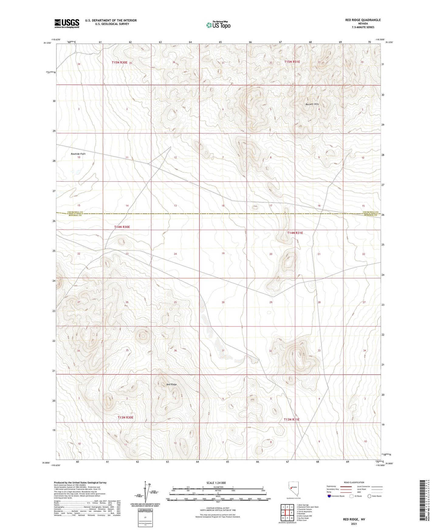
2021 topographic map quadrangle Red Ridge in the state of Nevada. Scale: 1:24000. Based on the newly updated USGS 7.5' US Topo map series, this map is in the following counties: Mineral, Churchill. The map contains contour data, water features, and other items you are used to seeing on USGS maps, but also has updated roads and other features. This is the next generation of topographic maps. Printed on high-quality waterproof paper with UV fade-resistant inks.
Quads adjacent to this one:
West: Terrill Mountains
Northwest: Allen Springs
North: Diamond Field Jack Wash
Northeast: Fourmile Canyon
East: Rawhide
Southeast: Pilot Cone
South: Hu-Pwi Wash
Southwest: Gillis Canyon NW
This map covers the same area as the classic USGS quad with code o39118a5.
Contains the following named places: Deep Hollow, Red Ridge