MyTopo
Riepetown Nevada US Topo Map
Couldn't load pickup availability
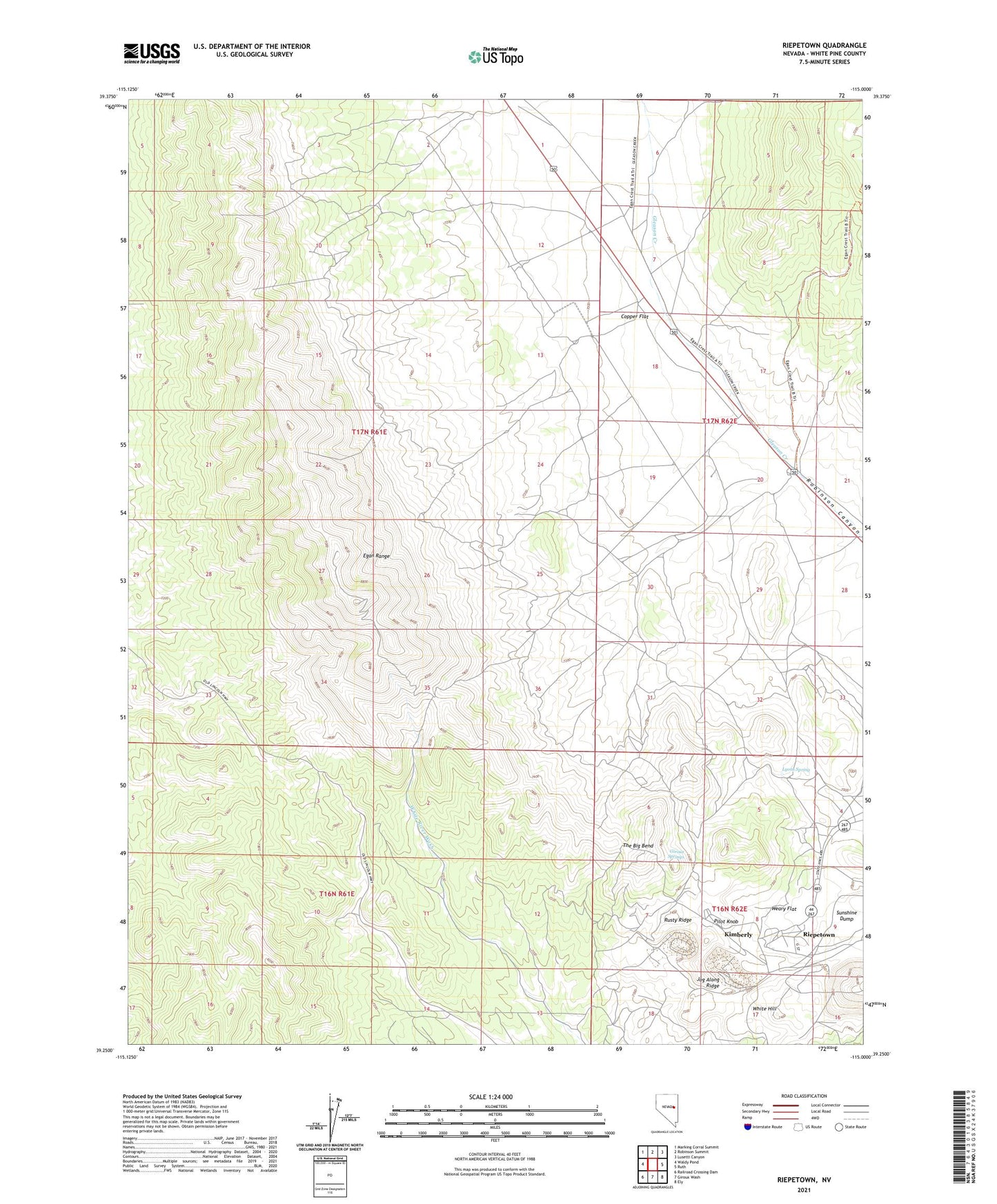
2021 topographic map quadrangle Riepetown in the state of Nevada. Scale: 1:24000. Based on the newly updated USGS 7.5' US Topo map series, this map is in the following counties: White Pine. The map contains contour data, water features, and other items you are used to seeing on USGS maps, but also has updated roads and other features. This is the next generation of topographic maps. Printed on high-quality waterproof paper with UV fade-resistant inks.
Quads adjacent to this one:
West: Waldy Pond
Northwest: Marking Corral Summit
North: Robinson Summit
Northeast: Lusetti Canyon
East: Ruth
Southeast: Ely
South: Giroux Wash
Southwest: Railroad Crossing Dam
This map covers the same area as the classic USGS quad with code o39115c1.
Contains the following named places: Alpha Shaft, Boston-Ely Shaft, Copper Flat, Copper Flat Well, Deep Well, Emma Nevada Shaft, Emma Shaft, Giroux Concentrator, Giroux Springs, Jog Along Ridge, Kimberly, Kimberly Post Office, Lyons Spring, Matilda Tunnel, Morris Shaft, Old Glory Shaft, Pilot Knob, Richard Shaft, Riepetown, Riepetown Post Office, Rusty Ridge, Taylor Mine, The Big Bend, Tripp Pit, Tripp Veteran Pit, Veteran, Veteran Pit, Veteran Shaft, Weary Flat, West Camp Well, White Hill