MyTopo
Rubber Hill Nevada US Topo Map
Couldn't load pickup availability
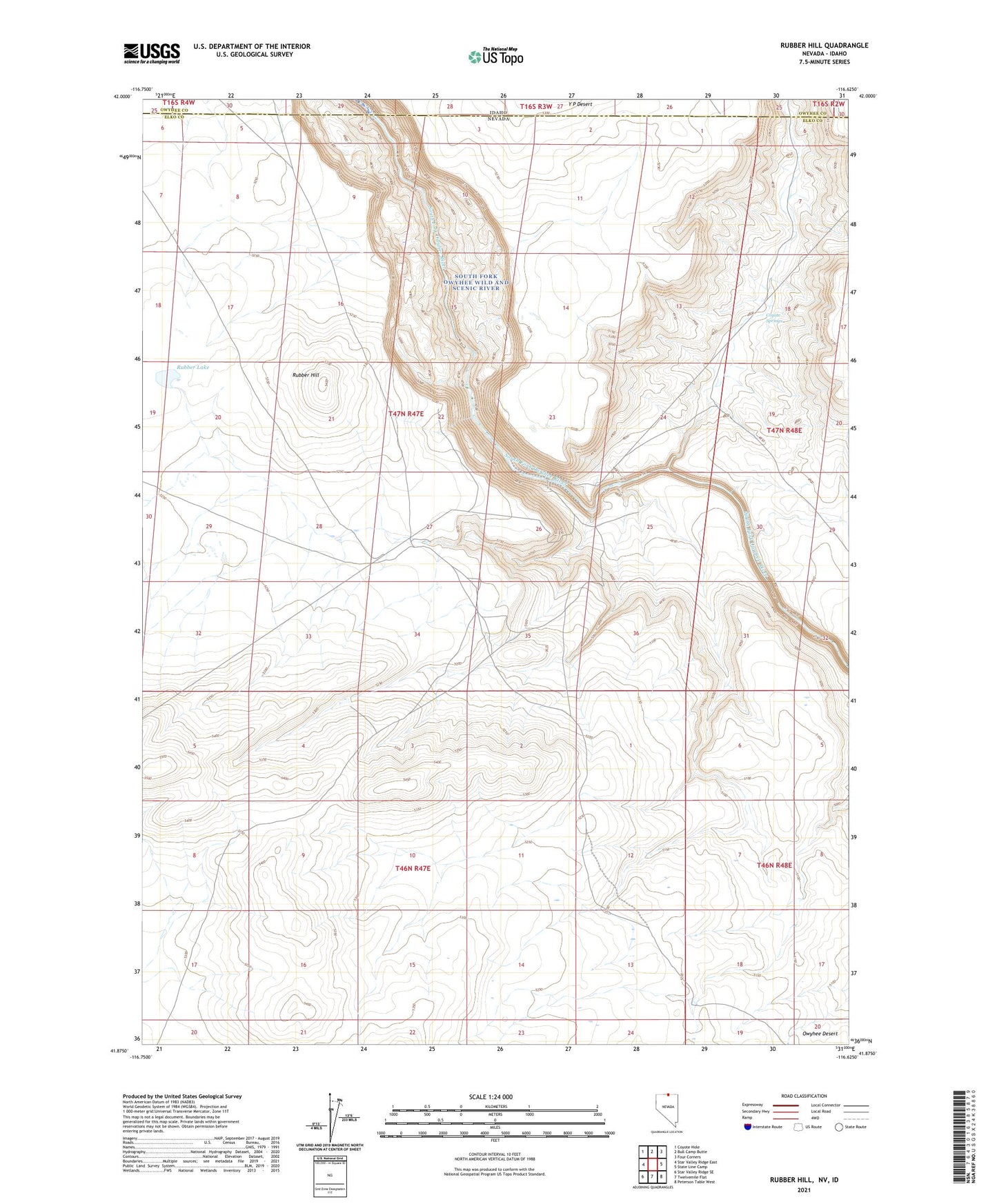
2021 topographic map quadrangle Rubber Hill in the states of Nevada, Idaho. Scale: 1:24000. Based on the newly updated USGS 7.5' US Topo map series, this map is in the following counties: Elko, Owyhee. The map contains contour data, water features, and other items you are used to seeing on USGS maps, but also has updated roads and other features. This is the next generation of topographic maps. Printed on high-quality waterproof paper with UV fade-resistant inks.
Quads adjacent to this one:
West: Star Valley Ridge East
Northwest: Coyote Hole
North: Bull Camp Butte
Northeast: Four Corners
East: State Line Camp
Southeast: Peterson Table West
South: Twelvemile Flat
Southwest: Star Valley Ridge SE
This map covers the same area as the classic USGS quad with code o41116h6.
Contains the following named places: Coyote Springs, Devils Corral, Rubber Hill, Rubber Lake, Stateline Windmill