MyTopo
Seligman Canyon Nevada US Topo Map
Couldn't load pickup availability
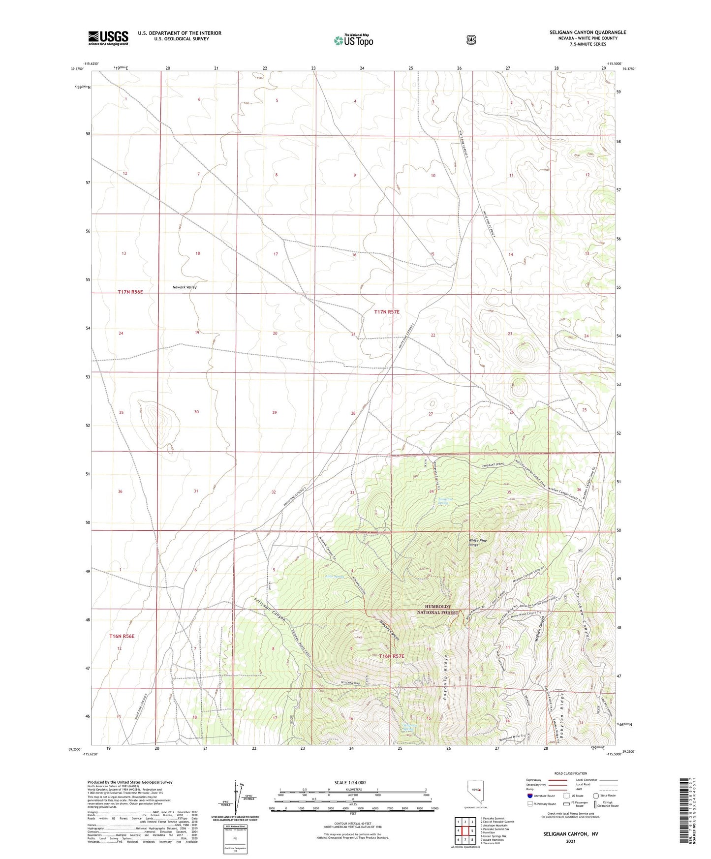
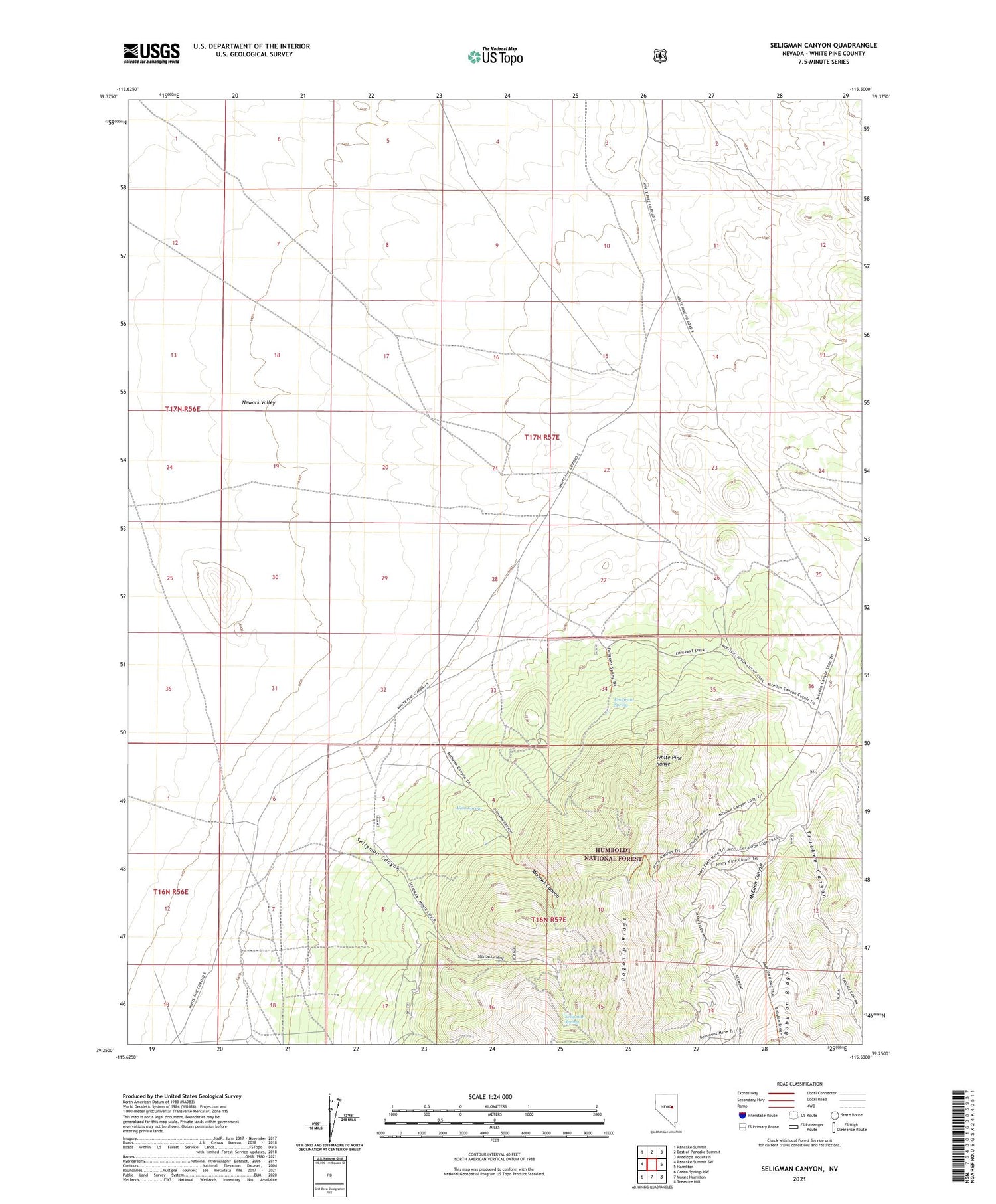
2021 topographic map quadrangle Seligman Canyon in the state of Nevada. Scale: 1:24000. Based on the newly updated USGS 7.5' US Topo map series, this map is in the following counties: White Pine. The map contains contour data, water features, and other items you are used to seeing on USGS maps, but also has updated roads and other features. This is the next generation of topographic maps. Printed on high-quality waterproof paper with UV fade-resistant inks.
Quads adjacent to this one:
West: Pancake Summit SW
Northwest: Pancake Summit
North: East of Pancake Summit
Northeast: Antelope Mountain
East: Hamilton
Southeast: Treasure Hill
South: Mount Hamilton
Southwest: Green Springs NW
Contains the following named places: Allan Spring, Belmont Mill, Belmont Mine, Black Jack Mine, Carters Well, Dog Star Mine, Emigrant Spring, Jenny A Mine, Mary Ellen Mine, McEllen Canyon, McEllen Mine, Mohawk Canyon, Seligman, Seligman Canyon, Seligman Mine, Seligman Post Office, Seligman Spring, Silver Bell Mine, Truckee Canyon