MyTopo
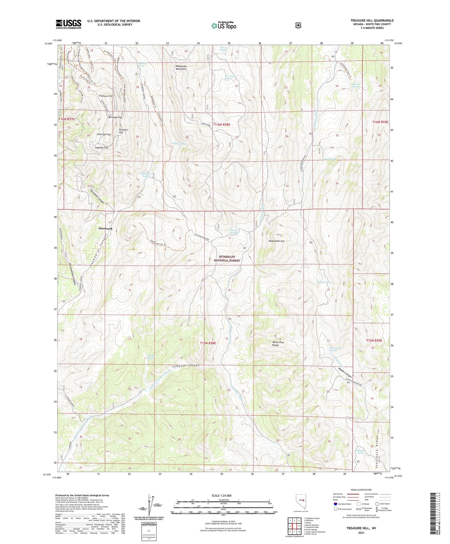
Treasure Hill Nevada US Topo Map
Couldn't load pickup availability
Also explore the Treasure Hill Forest Service Topo of this same quad for updated USFS data
2021 topographic map quadrangle Treasure Hill in the state of Nevada. Scale: 1:24000. Based on the newly updated USGS 7.5' US Topo map series, this map is in the following counties: White Pine. The map contains contour data, water features, and other items you are used to seeing on USGS maps, but also has updated roads and other features. This is the next generation of topographic maps. Printed on high-quality waterproof paper with UV fade-resistant inks.
Quads adjacent to this one:
West: Mount Hamilton
Northwest: Seligman Canyon
North: Hamilton
Northeast: Illipah
East: Limestone Peak
Southeast: Willow Grove
South: Indian Garden Mountain
Southwest: Green Springs
This map covers the same area as the classic USGS quad with code o39115b4.
Contains the following named places: Applegarth Spring, Argyle Mine, Aspen Springs, Aurora Mine, Big Smoky Mill, Blue Bell Mine, Bromide Flat, California Mill, Chicken Spring, Chloride Flat, Cow Track Spring, Eberhardt, Eberhardt Canyon, Eberhardt Mine, Eberhardt Post Office, Eberhardt Tunnel, Emersly Mine, Ephsum Spring, Fay Mine, Greenville, Hidden Treasure Mine, Hidden Treasure Two South Mine, International Mill, Keystone Mine, Lampson Spring, Mammoth Mine, Manhattan Mill, Mazeppa Mine, Menken, Mokomoke Hill, Mokomoke Mountains, Nevada Mill, North Sixmile Wash, Onetha Mine, Picotillo, Picotillo Flat, Pocotillo Mine, Pogonip, Pogonip Flat, Roadside Spring, Shellback Spring, Shermantown Canyon, Silver Glance Mine, Sixmile Springs, South Sixmile Wash, Stafford Shaft, Stanford Mill, Stone Cabin Spring, Treasure City, Treasure City Post Office, Treasure Hill, Treasure Quartz Mill, Virginia Mine, Ward Beecher Mine, Wheeler Tunnel, White Pine City, Willow Spring