MyTopo
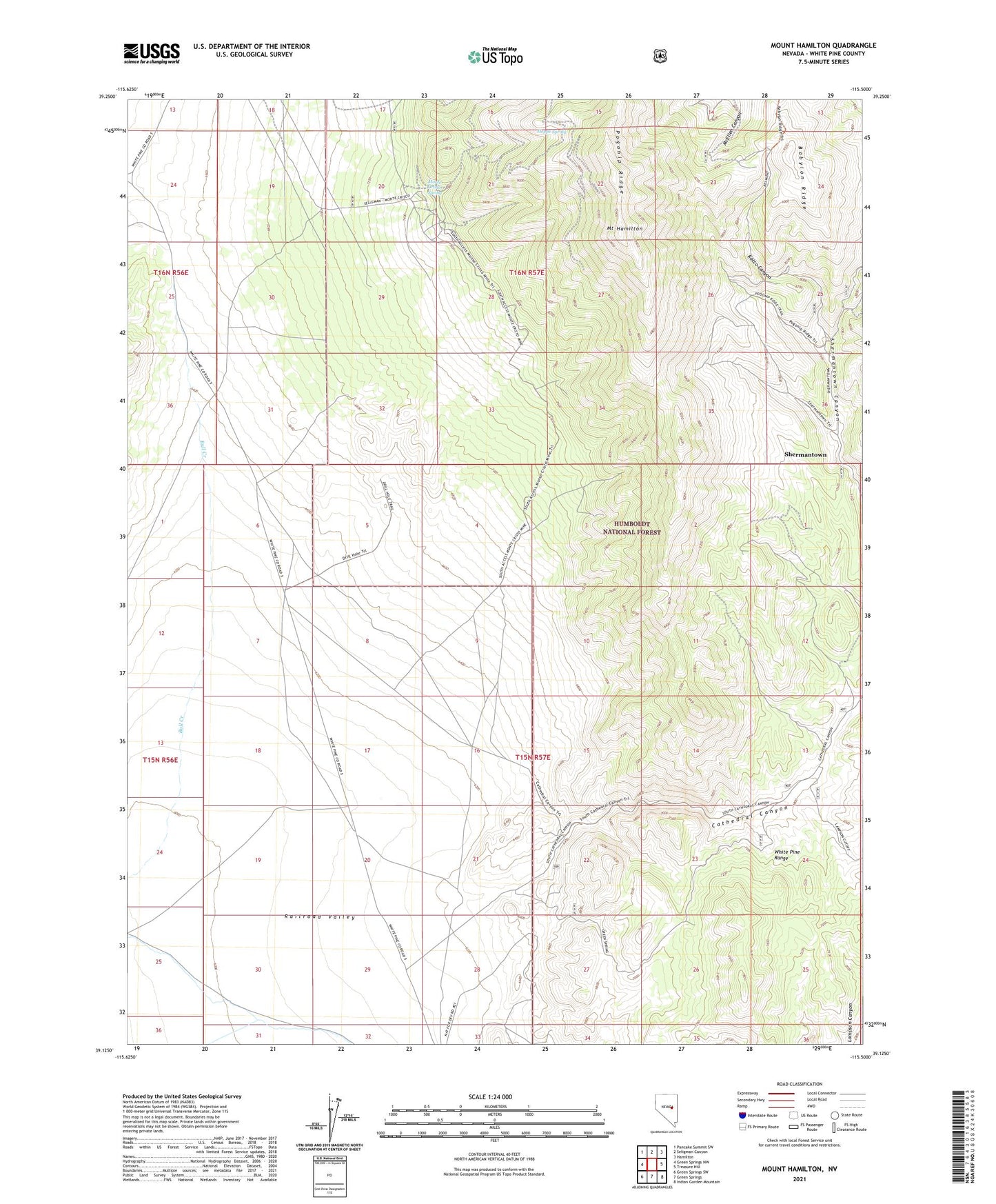
Mount Hamilton Nevada US Topo Map
Couldn't load pickup availability
Also explore the Mount Hamilton Forest Service Topo of this same quad for updated USFS data
2021 topographic map quadrangle Mount Hamilton in the state of Nevada. Scale: 1:24000. Based on the newly updated USGS 7.5' US Topo map series, this map is in the following counties: White Pine. The map contains contour data, water features, and other items you are used to seeing on USGS maps, but also has updated roads and other features. This is the next generation of topographic maps. Printed on high-quality waterproof paper with UV fade-resistant inks.
Quads adjacent to this one:
West: Green Springs NW
Northwest: Pancake Summit SW
North: Seligman Canyon
Northeast: Hamilton
East: Treasure Hill
Southeast: Indian Garden Mountain
South: Green Springs
Southwest: Green Springs SW
This map covers the same area as the classic USGS quad with code o39115b5.
Contains the following named places: Babylon, Babylon Ridge, Carbonate, Caroline Mine, Cathedral Canyon, Cathedral Well, Eberhardt Mill, Enterprise Mine, Grand Prize Mine, Great Valley Mine, Homestake Mine, Hoppe Spring, Metropolitan Mill, Monte Cristo, Monte Cristo Mill, Monte Cristo Spring, Mount Hamilton, Ne Plus Ultra Mine, Oasis Mill, Ora Mine, Pogonip Ridge, Rocco Canyon, Rocco Homestake Mine, Shermantown, Shermantown Post Office, Swansea, Swansea Mill, Vernon Mill, White Pine Mining District