MyTopo
Seven Troughs SE Nevada US Topo Map
Couldn't load pickup availability
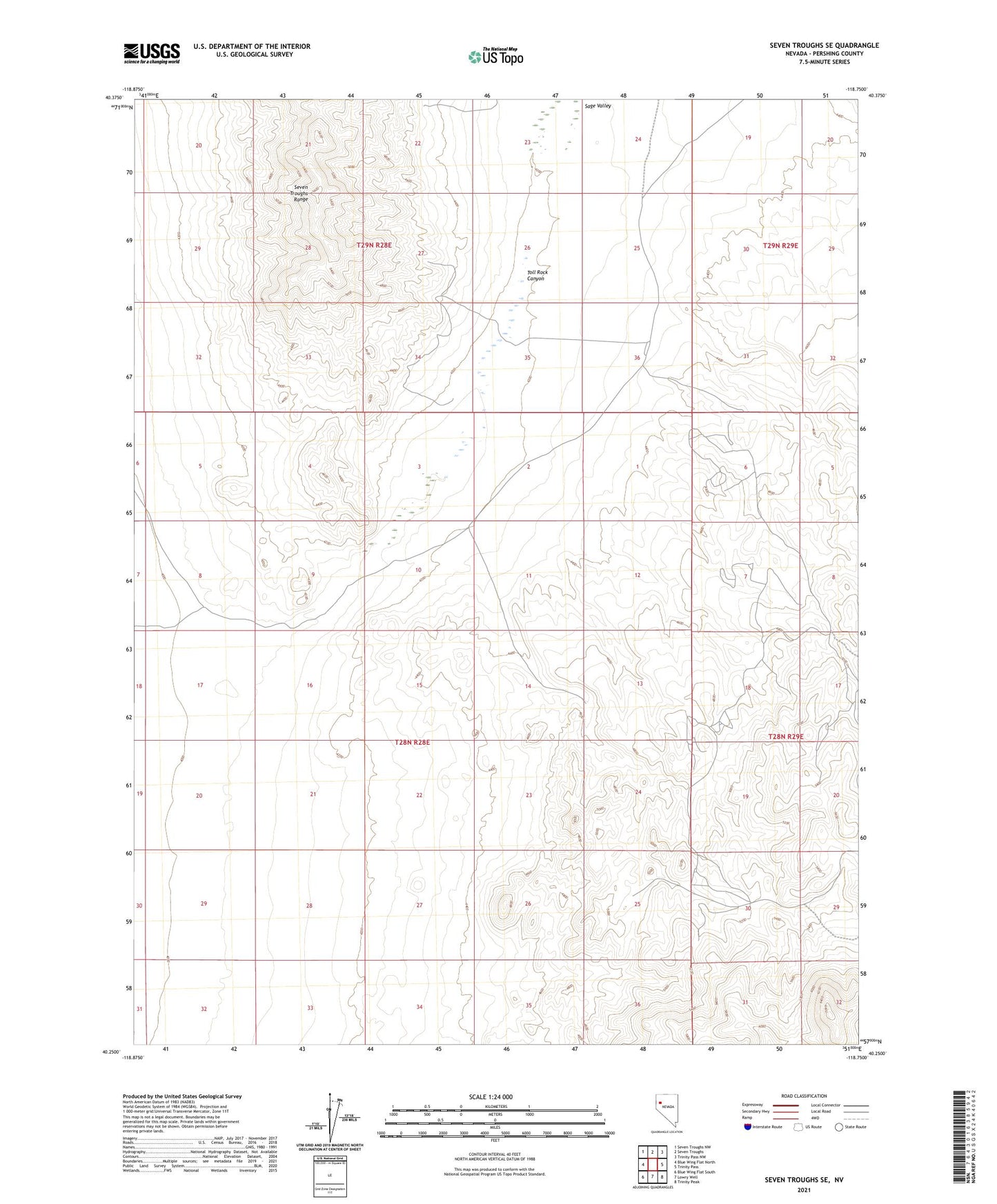
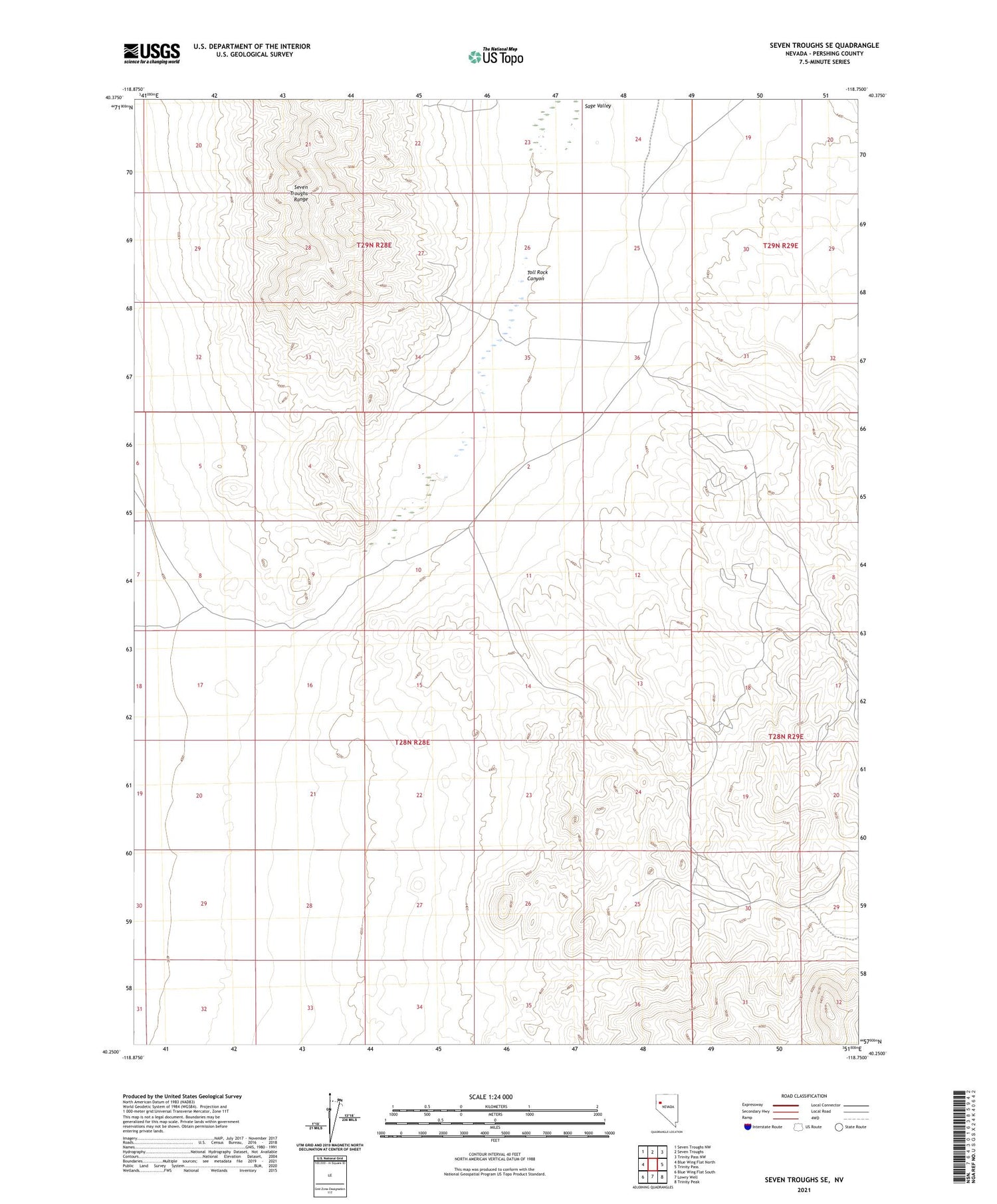
2021 topographic map quadrangle Seven Troughs SE in the state of Nevada. Scale: 1:24000. Based on the newly updated USGS 7.5' US Topo map series, this map is in the following counties: Pershing. The map contains contour data, water features, and other items you are used to seeing on USGS maps, but also has updated roads and other features. This is the next generation of topographic maps. Printed on high-quality waterproof paper with UV fade-resistant inks.
Quads adjacent to this one:
West: Blue Wing Flat North
Northwest: Seven Troughs NW
North: Seven Troughs
Northeast: Trinity Pass NW
East: Trinity Pass
Southeast: Trinity Peak
South: Lowry Well
Southwest: Blue Wing Flat South
Contains the following named places: Antelope Basin Mine, Burro Basin Mine, Eagle Picher Mine, Eagle Pitcher Mine, Toll Rock Canyon, Tunnel Hill Mine