MyTopo
Seven Troughs Nevada US Topo Map
Couldn't load pickup availability
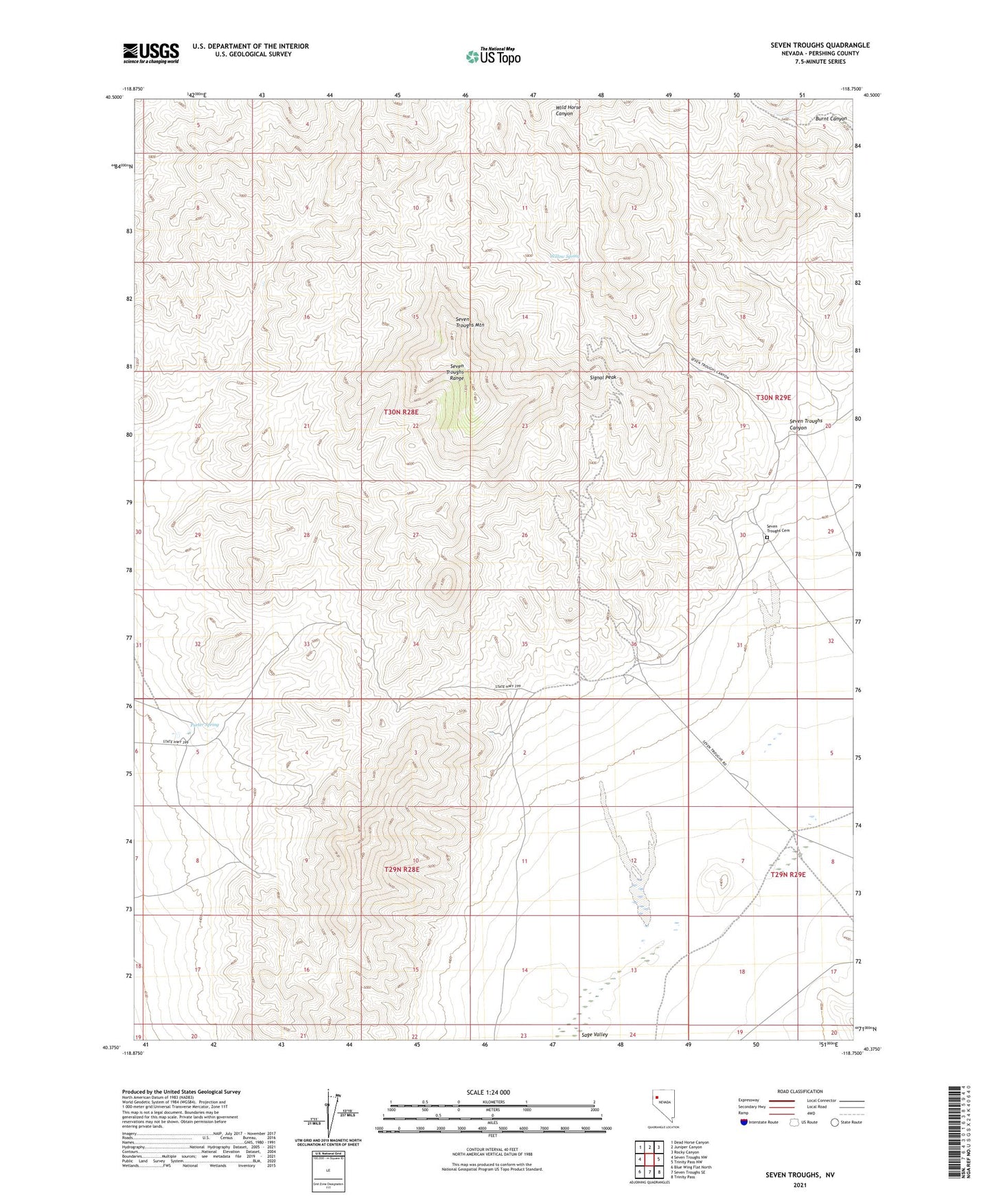
2021 topographic map quadrangle Seven Troughs in the state of Nevada. Scale: 1:24000. Based on the newly updated USGS 7.5' US Topo map series, this map is in the following counties: Pershing. The map contains contour data, water features, and other items you are used to seeing on USGS maps, but also has updated roads and other features. This is the next generation of topographic maps. Printed on high-quality waterproof paper with UV fade-resistant inks.
Quads adjacent to this one:
West: Seven Troughs NW
Northwest: Dead Horse Canyon
North: Juniper Canyon
Northeast: Rocky Canyon
East: Trinity Pass NW
Southeast: Trinity Pass
South: Seven Troughs SE
Southwest: Blue Wing Flat North
This map covers the same area as the classic USGS quad with code o40118d7.
Contains the following named places: Bach Well, Coalition Cyanide Mill, Darby Mill, Fairview Mine, Friedman Tunnel Portal, Friedmans Mill, Holiday Mine, J and B Group Mine, Kindergarten-Therian Group Mine, Mazuma, Mazuma Hills Mill, Mazuma Post Office, Michigan Mine, Porter Spring, Portland Mine, Preston Mill, Seven Troughs, Seven Troughs Canyon, Seven Troughs Gold Mines Company Mines, Seven Troughs Kingergarten Mill, Seven Troughs Mining District, Seven Troughs Mountain, Seven Troughs Post Office, Seven Troughs Range, Signal Peak, Sugar Loaf Mine, Sure Thing Mine, The Causten Mill, The Rogers Mill, Tunnel Camp, Vernon, Vernon Mine, Vernon Post Office, Wild Horse Canyon, Willow Spring, Womens Right Group Mine