MyTopo
Sheep Ranch Canyon Nevada US Topo Map
Couldn't load pickup availability
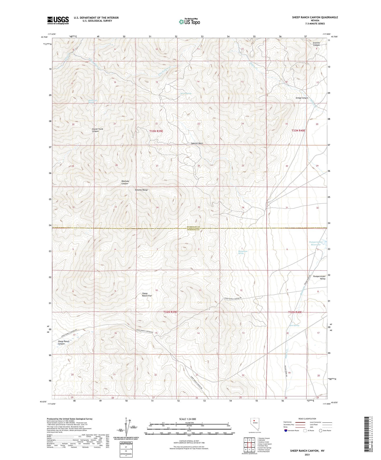
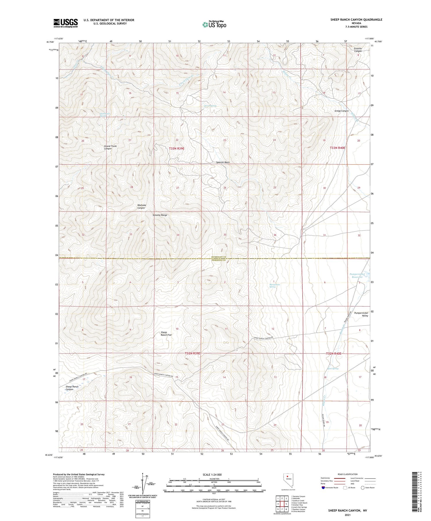
2021 topographic map quadrangle Sheep Ranch Canyon in the state of Nevada. Scale: 1:24000. Based on the newly updated USGS 7.5' US Topo map series, this map is in the following counties: Humboldt, Pershing. The map contains contour data, water features, and other items you are used to seeing on USGS maps, but also has updated roads and other features. This is the next generation of topographic maps. Printed on high-quality waterproof paper with UV fade-resistant inks.
Quads adjacent to this one:
West: Clear Creek Ranch
Northwest: Sonoma Canyon
North: Adelaide
Northeast: Goldrun Creek
East: Smelser Pass
Southeast: China Mountain
South: Panther Canyon
Southwest: Leach Hot Springs
Contains the following named places: Black Diablo Mine, Black Diablo Mining District, Borrel Spring, Buckbrush Spring, East Fork Clear Creek, Granite Canyon, Gregg Canyon, Horton Mercury Mine, Kent Spring, Manganese Spring, Sheep Ranch, Sheep Ranch Canyon, Sheep Ranch Flat, Sonoma Range, Spanish Basin