MyTopo
Goldrun Creek Nevada US Topo Map
Couldn't load pickup availability
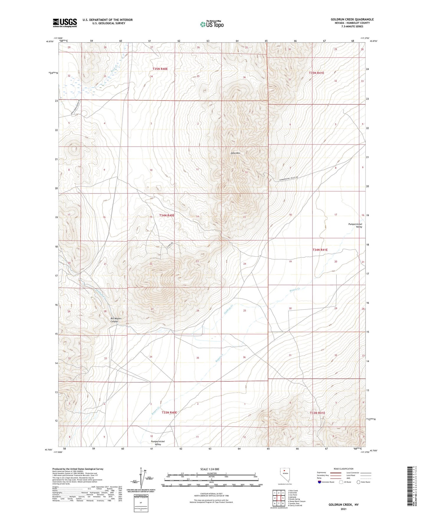
2021 topographic map quadrangle Goldrun Creek in the state of Nevada. Scale: 1:24000. Based on the newly updated USGS 7.5' US Topo map series, this map is in the following counties: Humboldt. The map contains contour data, water features, and other items you are used to seeing on USGS maps, but also has updated roads and other features. This is the next generation of topographic maps. Printed on high-quality waterproof paper with UV fade-resistant inks.
Quads adjacent to this one:
West: Adelaide
Northwest: Pole Creek
North: Golconda
Northeast: Iron Point
East: Brooks Spring
Southeast: Cherry Creek NE
South: Smelser Pass
Southwest: Sheep Ranch Canyon
This map covers the same area as the classic USGS quad with code o40117g4.
Contains the following named places: Adelaide Mine, Bill Majors Canyon, Cumberland Creek, Edna Mountain, Goldrun Creek, Holts Quartz Mill, Hot Springs Ranch, Kent Ranch, Robber Creek