MyTopo
South Schell Peak Nevada US Topo Map
Couldn't load pickup availability
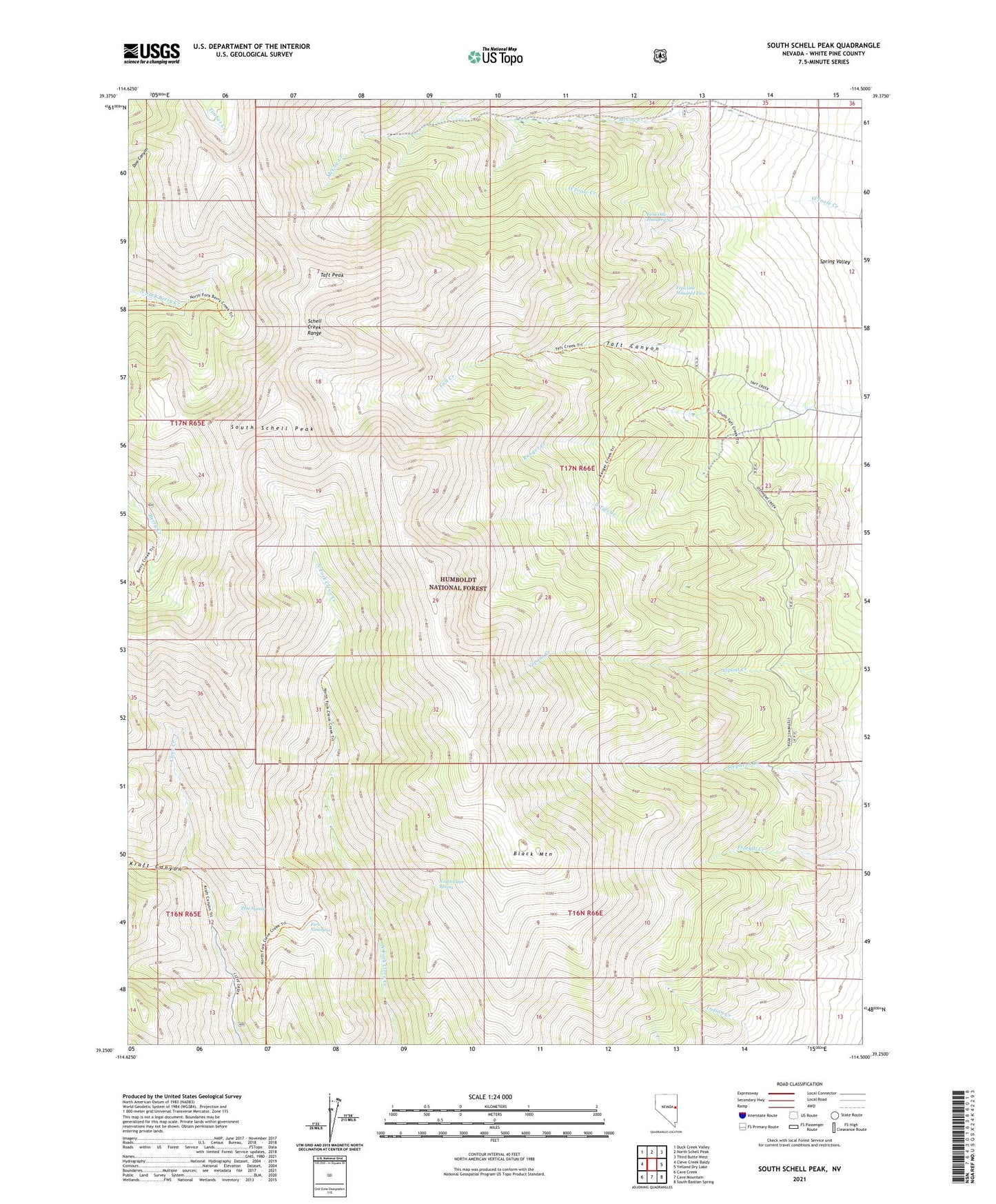
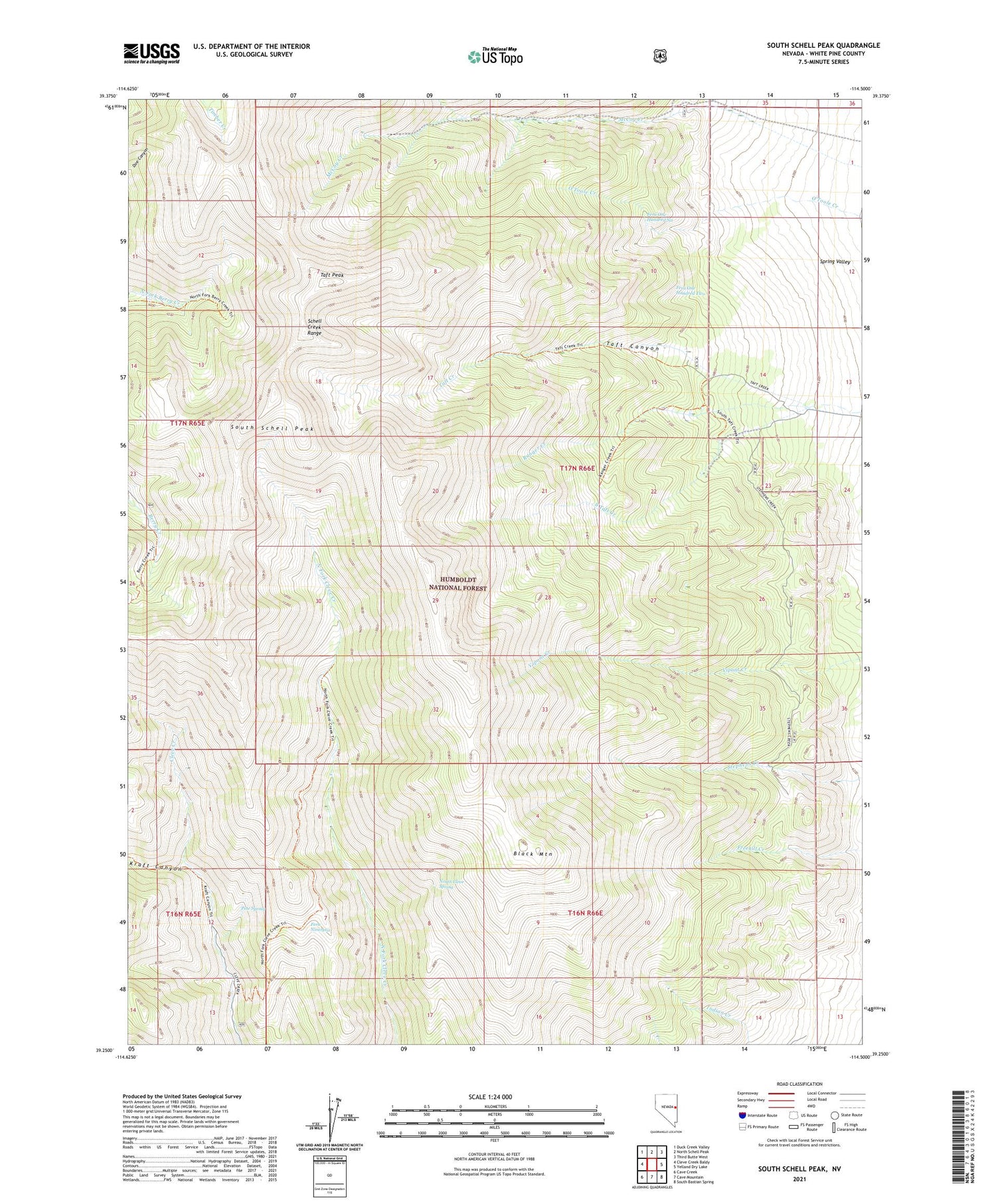
2021 topographic map quadrangle South Schell Peak in the state of Nevada. Scale: 1:24000. Based on the newly updated USGS 7.5' US Topo map series, this map is in the following counties: White Pine. The map contains contour data, water features, and other items you are used to seeing on USGS maps, but also has updated roads and other features. This is the next generation of topographic maps. Printed on high-quality waterproof paper with UV fade-resistant inks.
Quads adjacent to this one:
West: Cleve Creek Baldy
Northwest: Duck Creek Valley
North: North Schell Peak
Northeast: Third Butte West
East: Yelland Dry Lake
Southeast: South Bastian Spring
South: Cave Mountain
Southwest: Cave Creek
Contains the following named places: Black Mountain, Ely Ranger District, Fera Ninetysix, Fera One Hundred Six, Fera One Hundred Two, High Schells Wilderness, Kraft Canyon, McCoy, McCoy Creek, North Cleve Spring, Pete Spring, Ranger Creek, South Schell Peak, Taft Canyon, Taft Peak