
MyTopo
Sulphur Nevada US Topo Map
Couldn't load pickup availability
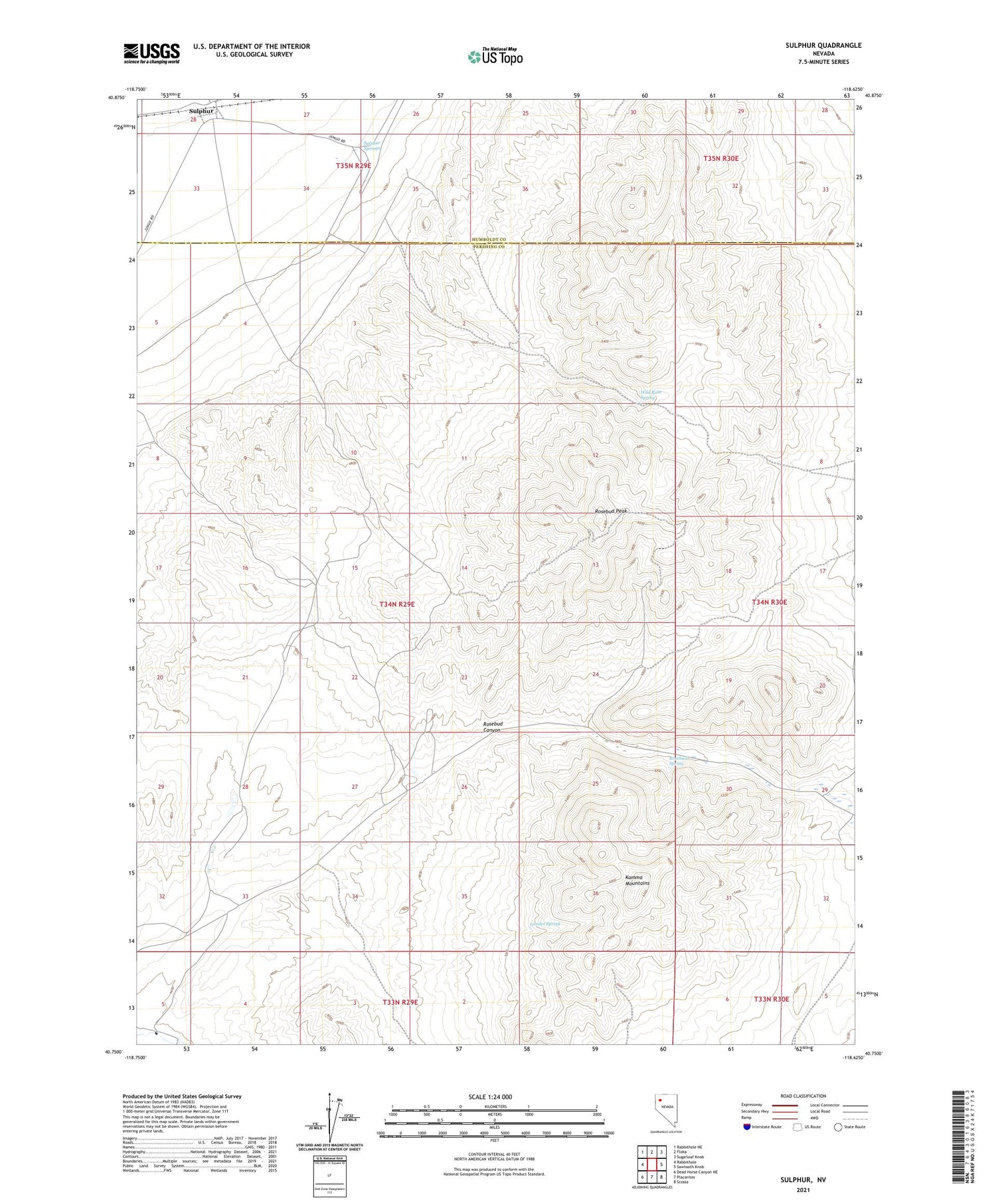
2021 topographic map quadrangle Sulphur in the state of Nevada. Scale: 1:24000. Based on the newly updated USGS 7.5' US Topo map series, this map is in the following counties: Pershing, Humboldt. The map contains contour data, water features, and other items you are used to seeing on USGS maps, but also has updated roads and other features. This is the next generation of topographic maps. Printed on high-quality waterproof paper with UV fade-resistant inks.
Quads adjacent to this one:
West: Rabbithole
Northwest: Rabbithole NE
North: Floka
Northeast: Sugarloaf Knob
East: Sawtooth Knob
Southeast: Scossa
South: Placerites
Southwest: Dead Horse Canyon NE
Contains the following named places: Abe Lincoln Mine, Barrell Springs, Brown Palace Mine, Constant Minerals Separation Company Mines, Double O Mine, Dreamland Mine, Durango Girl Mine, Goldbud, Grubstake Mine, H and M Number 1 Mine, Kamma Mountains, Lander Spring, Rabbit Hole Mining District, Rosebud, Rosebud Canyon, Rosebud Mine, Rosebud Mining District, Rosebud Peak, Rosebud Post Office, Rosebud Spring, Silver Camel Mine, Sulphur, Sulphur Airport, Sulphur Mine, Sulphur Post Office, Sulphur Springs, Wild Rose Spring


