MyTopo
Scossa Nevada US Topo Map
Couldn't load pickup availability
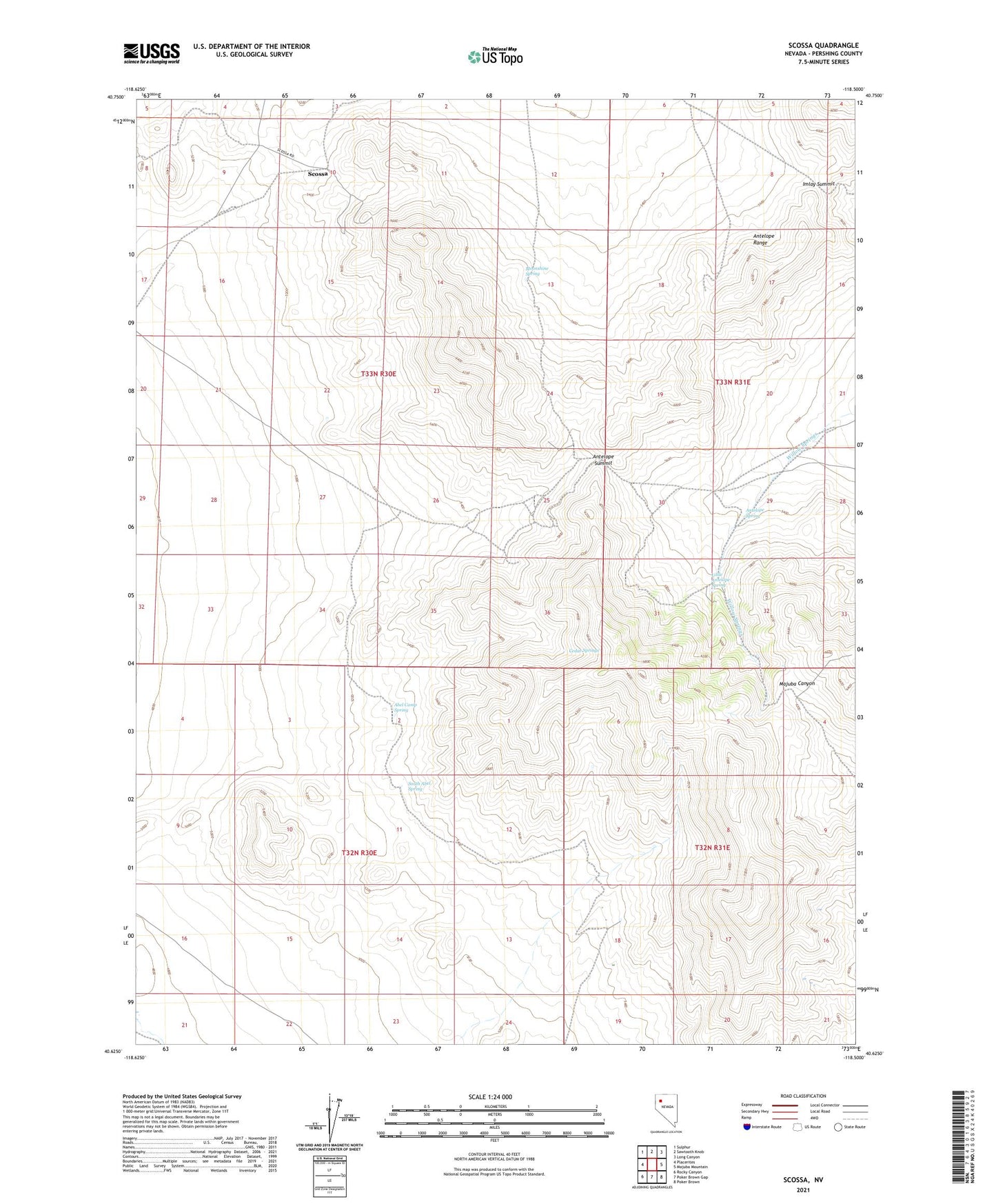
2021 topographic map quadrangle Scossa in the state of Nevada. Scale: 1:24000. Based on the newly updated USGS 7.5' US Topo map series, this map is in the following counties: Pershing. The map contains contour data, water features, and other items you are used to seeing on USGS maps, but also has updated roads and other features. This is the next generation of topographic maps. Printed on high-quality waterproof paper with UV fade-resistant inks.
Quads adjacent to this one:
West: Placerites
Northwest: Sulphur
North: Sawtooth Knob
Northeast: Long Canyon
East: Majuba Mountain
Southeast: Poker Brown
South: Poker Brown Gap
Southwest: Rocky Canyon
This map covers the same area as the classic USGS quad with code o40118f5.
Contains the following named places: Abel Camp Spring, Antelope Mine, Antelope Spring, Antelope Summit, Cedar Springs, Hawkeye Mine, Imlay Summit, Keough-Noble Mine, Little Antelope Spring, Mohawk Mine, Moonshine Spring, Noble Mine, North Star Mine, Scossa, Scossa Mining District, South Abel Spring, Superior Mine