MyTopo
Thunder Mountain Nevada US Topo Map
Couldn't load pickup availability
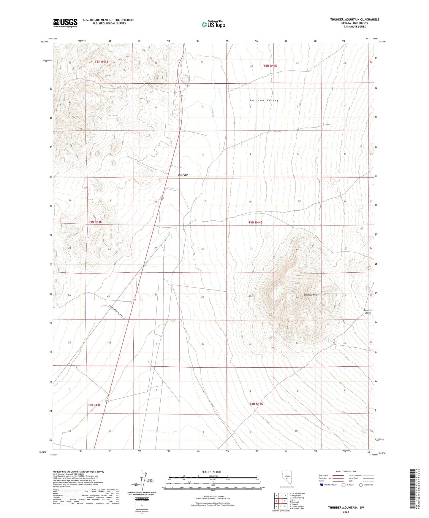
2021 topographic map quadrangle Thunder Mountain in the state of Nevada. Scale: 1:24000. Based on the newly updated USGS 7.5' US Topo map series, this map is in the following counties: Nye. The map contains contour data, water features, and other items you are used to seeing on USGS maps, but also has updated roads and other features. This is the next generation of topographic maps. Printed on high-quality waterproof paper with UV fade-resistant inks.
Quads adjacent to this one:
West: Rays
Northwest: San Antonio Well
North: Henrys Well
Northeast: Antelope Spring
East: Hannapah
Southeast: McKinney Tanks
South: East of Tonopah
Southwest: Tonopah
This map covers the same area as the classic USGS quad with code o38117b1.
Contains the following named places: Hunts Creek, Lucky Boy Number Two Mine, Maggie Blues, Midway Mine, Rye Patch, Rye Patch Pumping Station, Silver Ace Number One Mine, Thunder Mountain