MyTopo
Tognini Spring Nevada US Topo Map
Couldn't load pickup availability
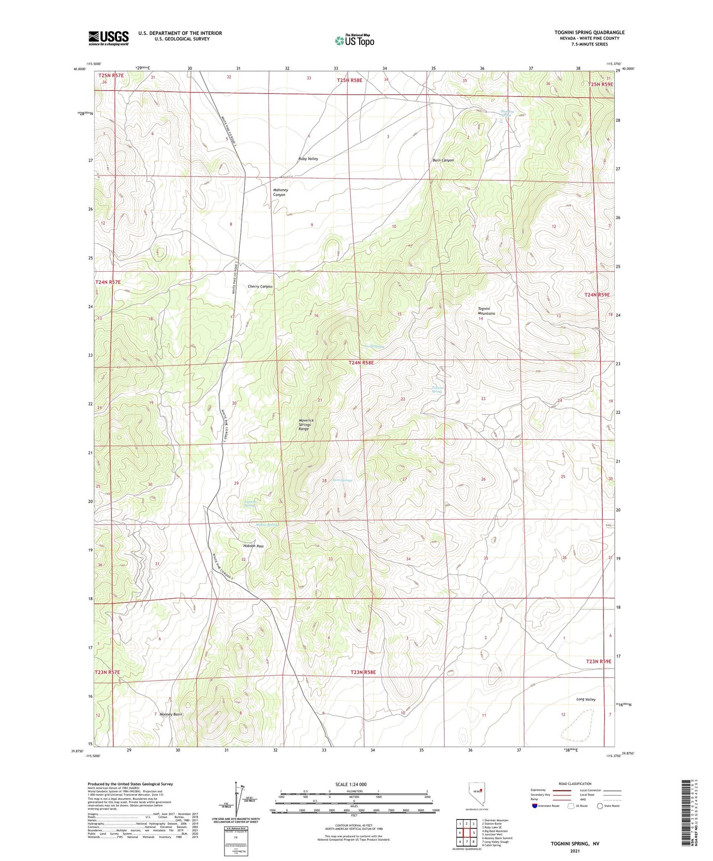
2021 topographic map quadrangle Tognini Spring in the state of Nevada. Scale: 1:24000. Based on the newly updated USGS 7.5' US Topo map series, this map is in the following counties: White Pine. The map contains contour data, water features, and other items you are used to seeing on USGS maps, but also has updated roads and other features. This is the next generation of topographic maps. Printed on high-quality waterproof paper with UV fade-resistant inks.
Quads adjacent to this one:
West: Big Bald Mountain
Northwest: Sherman Mountain
North: Station Butte
Northeast: Ruby Lake SE
East: Junction Well
Southeast: Cabin Spring
South: Long Valley Slough
Southwest: Mooney Basin Summit
Contains the following named places: Blue Jay Ranch, Blue Jay Spring, Burn Canyon, Cherry Canyon, Hobson Pass, Julian Well, Jupresti Spring, Mahoney Canyon, North Spring, Tognini Mountains, Tognini Spring, Twin Springs, Willow Spring