MyTopo
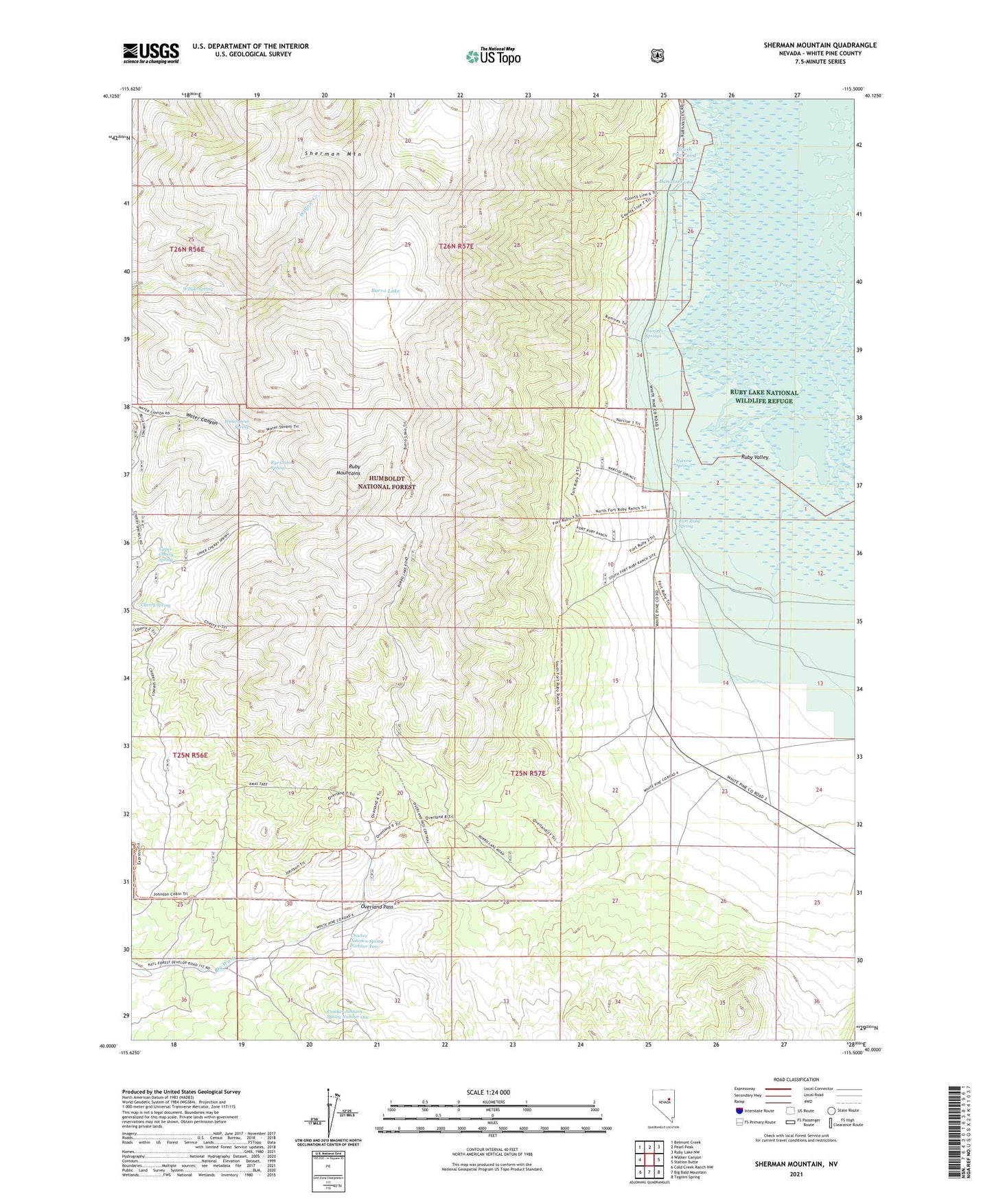
Sherman Mountain Nevada US Topo Map
Couldn't load pickup availability
Also explore the Sherman Mountain Forest Service Topo of this same quad for updated USFS data
2021 topographic map quadrangle Sherman Mountain in the state of Nevada. Scale: 1:24000. Based on the newly updated USGS 7.5' US Topo map series, this map is in the following counties: White Pine. The map contains contour data, water features, and other items you are used to seeing on USGS maps, but also has updated roads and other features. This is the next generation of topographic maps. Printed on high-quality waterproof paper with UV fade-resistant inks.
Quads adjacent to this one:
West: Walker Canyon
Northwest: Belmont Creek
North: Pearl Peak
Northeast: Ruby Lake NW
East: Station Butte
Southeast: Tognini Spring
South: Big Bald Mountain
Southwest: Cold Creek Ranch NW
This map covers the same area as the classic USGS quad with code o40115a5.
Contains the following named places: Banana Pond, Brush Pile Pond, Burro Lake, Cherry Spring, County Line Pond, Cracker Johnson Spring Number One, Cracker Johnson Spring Number Two, Davis Ranch, Fort Ruby, Fort Ruby Ranch, Fort Ruby Ranch Airstrip, Fort Ruby Spring, Hobson, Hobson Post Office, Johnson Cabin, Narcise Springs, Overland Pass, Pony Express Station, Ramires Springs, Rye Grass Spring, Sherman Mountain, Upper Cherry Spring, Waterspout Spring, Willow Spring