MyTopo
Tonopah Nevada US Topo Map
Couldn't load pickup availability
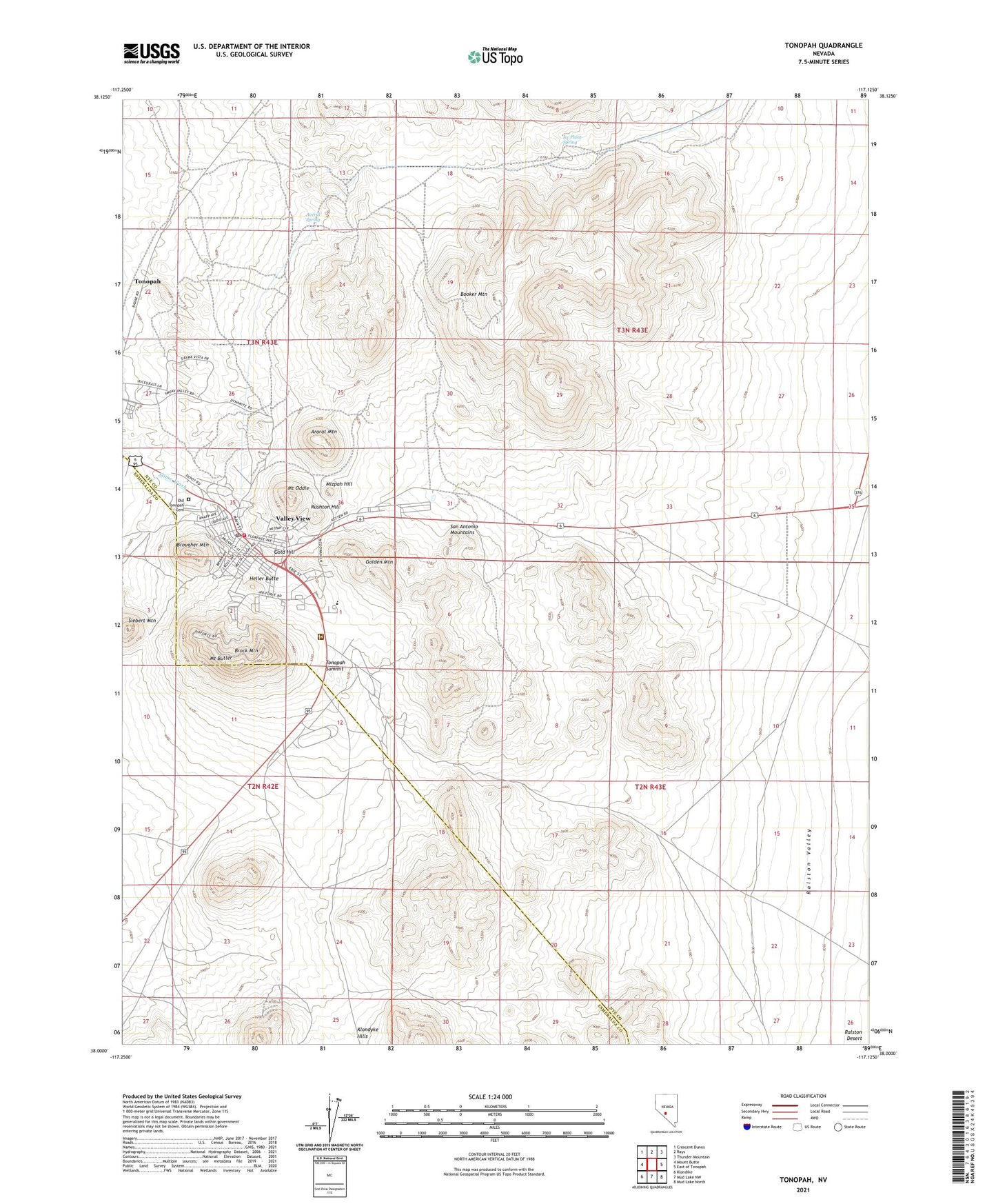
2021 topographic map quadrangle Tonopah in the state of Nevada. Scale: 1:24000. Based on the newly updated USGS 7.5' US Topo map series, this map is in the following counties: Nye, Esmeralda. The map contains contour data, water features, and other items you are used to seeing on USGS maps, but also has updated roads and other features. This is the next generation of topographic maps. Printed on high-quality waterproof paper with UV fade-resistant inks.
Quads adjacent to this one:
West: Mount Butte
Northwest: Crescent Dunes
North: Rays
Northeast: Thunder Mountain
East: East of Tonopah
South: Mud Lake NW
Southwest: Klondike
Contains the following named places: Acenith, Ararat Mountain, Averill Spring, Barsanti Park, Belle of Tonopah, Belmont, Big Tono, Booker Mountain, Boston Tonopah, Brock Mountain, Brougher Mountain, Buckeye Belmont Mine, Butler Park, Butte Tonopah, California Mine, Cash Boy Mine, Central Nevada Museum, Desert Queen, Fabbi Mine, Fraction Extension, Fraction Number 1 Mine, Fraction Number 2 Mine, Gold Hill, Gold Hill Shaft, Golden Anchor, Golden Mountain, Great Western Mine, Gypsy Queen Mine, Halifax, Heller Butte, Henderson Park, Highland Park, Hooper Well, Ice Plant Spring, Jim Butler Mine, King Tonopah, KPAH-FM (Tonopah), KTPH-FM (Tonopah), Logan Field, MacNamara, McKane Mine, McNamara Mill, Midway Mine, Mizpah Extension, Mizpah Hill, Mizpah Mine, Molly, Monarch Pittsburg Mine, Montana Tonopah, Montana Tonopah Mill, Mount Butler, Mount Oddie, Nevada Highway Patrol Northern Command - Tonopah Station, New Golden Crown Mine, New West End Mine, New York Tonopah, North Star, Nye County Court House, Nye Regional Medical Center, Ohio Tonopah, Old Tonopah Cemetery, Old West End Mine, Red Plume Shaft, Rescue Eula Mine, Rushton Hill, San Antonio Mountains, Sand Grass Shaft, Sieber, Siebert Mountain, Silver Rim Elementary School, Silver Top Mine, Stone Cabin, Stone Cabin Mine, Tonopah, Tonopah Air Force Station, Tonopah and California Mine, Tonopah Beacon, Tonopah Belmont Development Mill, Tonopah Belmont Mill, Tonopah Belmont Mine, Tonopah Census Designated Place, Tonopah Central Mine, Tonopah City Mine, Tonopah Elementary School, Tonopah Extension, Tonopah Extension Mill, Tonopah Extension New Shaft, Tonopah High School, Tonopah Merger Mine, Tonopah Midway New Shaft, Tonopah Post Office, Tonopah Summit, Tonopah Volunteer Ambulance Service, Tonopah Volunteer Fire Department, Umatilla Tonopah Mine, Valley View, Valley View Mine, Victor Mine, Wandering Boy Mine, West End Mill, West End Mine