MyTopo
Mount Butte Nevada US Topo Map
Couldn't load pickup availability
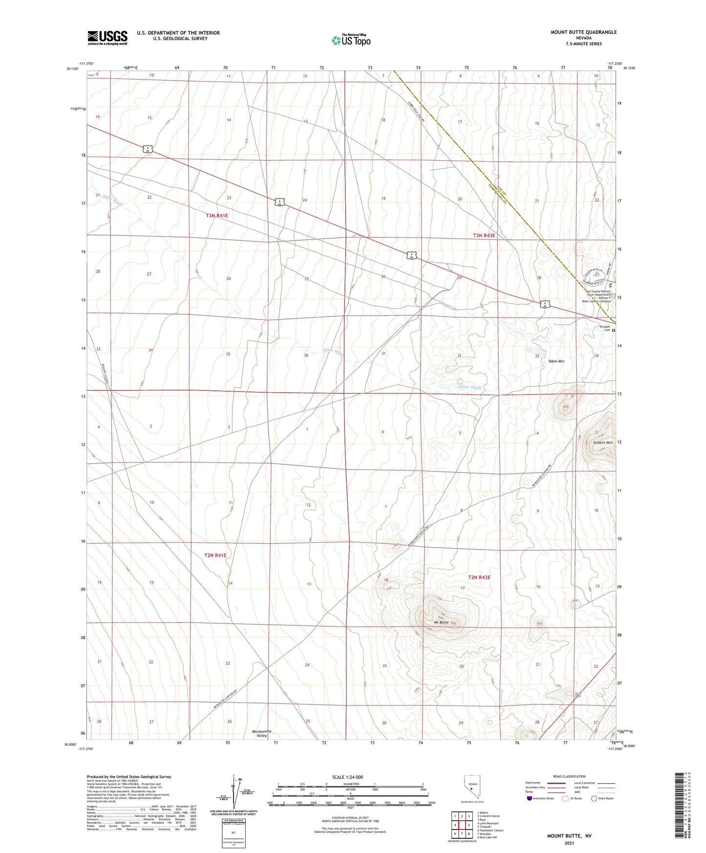
2021 topographic map quadrangle Mount Butte in the state of Nevada. Scale: 1:24000. Based on the newly updated USGS 7.5' US Topo map series, this map is in the following counties: Esmeralda, Nye. The map contains contour data, water features, and other items you are used to seeing on USGS maps, but also has updated roads and other features. This is the next generation of topographic maps. Printed on high-quality waterproof paper with UV fade-resistant inks.
Quads adjacent to this one:
West: Lone Mountain
Northwest: Millers
North: Crescent Dunes
Northeast: Rays
East: Tonopah
Southeast: Mud Lake NW
South: Klondike
Southwest: Paymaster Canyon
This map covers the same area as the classic USGS quad with code o38117a3.
Contains the following named places: Belcher Divide Mine, Columbia Junction, Divide, Divide Post Office, Garibaldi Mine, Hill of Gold Mine, Keystone Mine, Lambertucci Airstrip, McSweeney, Monarch Mine, Mount Butte, Nye County Sheriff's Office Substation, Silver Queen Mine, Sweeney Junction, Table Mountain, Three Hills Mine, Tonopah Cemetery, Tonopah Mine, West Tonopah Mine