
MyTopo
Valley Nevada US Topo Map
Couldn't load pickup availability
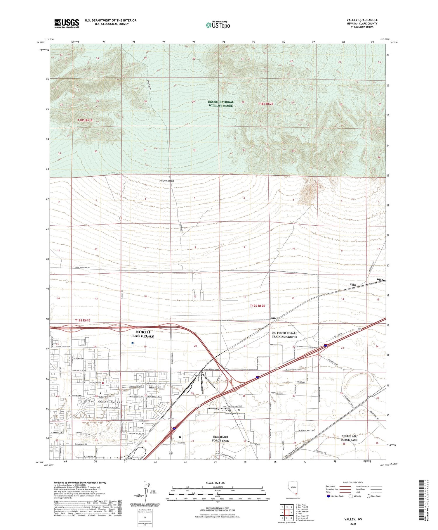
2021 topographic map quadrangle Valley in the state of Nevada. Scale: 1:24000. Based on the newly updated USGS 7.5' US Topo map series, this map is in the following counties: Clark. The map contains contour data, water features, and other items you are used to seeing on USGS maps, but also has updated roads and other features. This is the next generation of topographic maps. Printed on high-quality waterproof paper with UV fade-resistant inks.
Quads adjacent to this one:
North: Gass Peak NE
Northeast: Dry Lake NW
East: Apex
Southeast: Frenchman Mountain
South: Las Vegas NE
Southwest: Las Vegas NW
Contains the following named places: City of North Las Vegas, Department of Veterans Affairs Southern Nevada Healthcare System - North Las Vegas Medical Center, Dike, Florence McClure Women's Correctional Center, John Tartan Elementary School, Jungletown, KLUC-AM (North Las Vegas), Las Vegas Motor Speedway, Lovell, North Las Vegas Fire Department Station 57, Summit View Correctional Center, Valley, ZIP Codes: 89081, 89086, 89115


