MyTopo
Apex Nevada US Topo Map
Couldn't load pickup availability
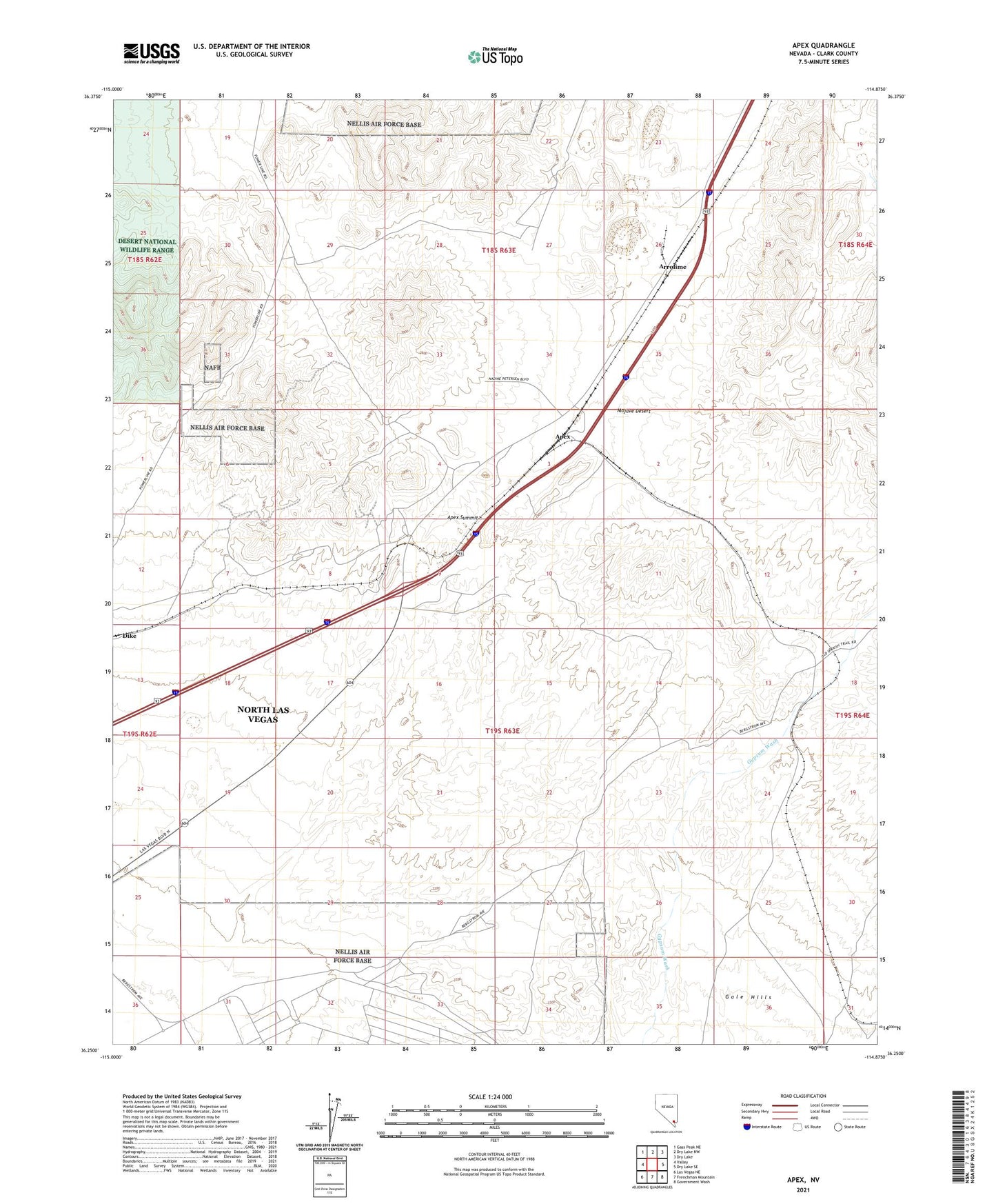
2021 topographic map quadrangle Apex in the state of Nevada. Scale: 1:24000. Based on the newly updated USGS 7.5' US Topo map series, this map is in the following counties: Clark. The map contains contour data, water features, and other items you are used to seeing on USGS maps, but also has updated roads and other features. This is the next generation of topographic maps. Printed on high-quality waterproof paper with UV fade-resistant inks.
Quads adjacent to this one:
West: Valley
Northwest: Gass Peak NE
North: Dry Lake NW
Northeast: Dry Lake
East: Dry Lake SE
Southeast: Government Wash
South: Frenchman Mountain
Southwest: Las Vegas NE
This map covers the same area as the classic USGS quad with code o36114c8.
Contains the following named places: Apex, Apex Limstone Quarry, Apex Mining District, Apex Summit, Apex Underpass, Arrolime, Dike Mining District, Lake Mead Base Branch Post Office, Las Vegas Dunes Recreation Lands, Lead King Mine